€ 13.95
Wegenkaart - landkaart Ontario | ITMB

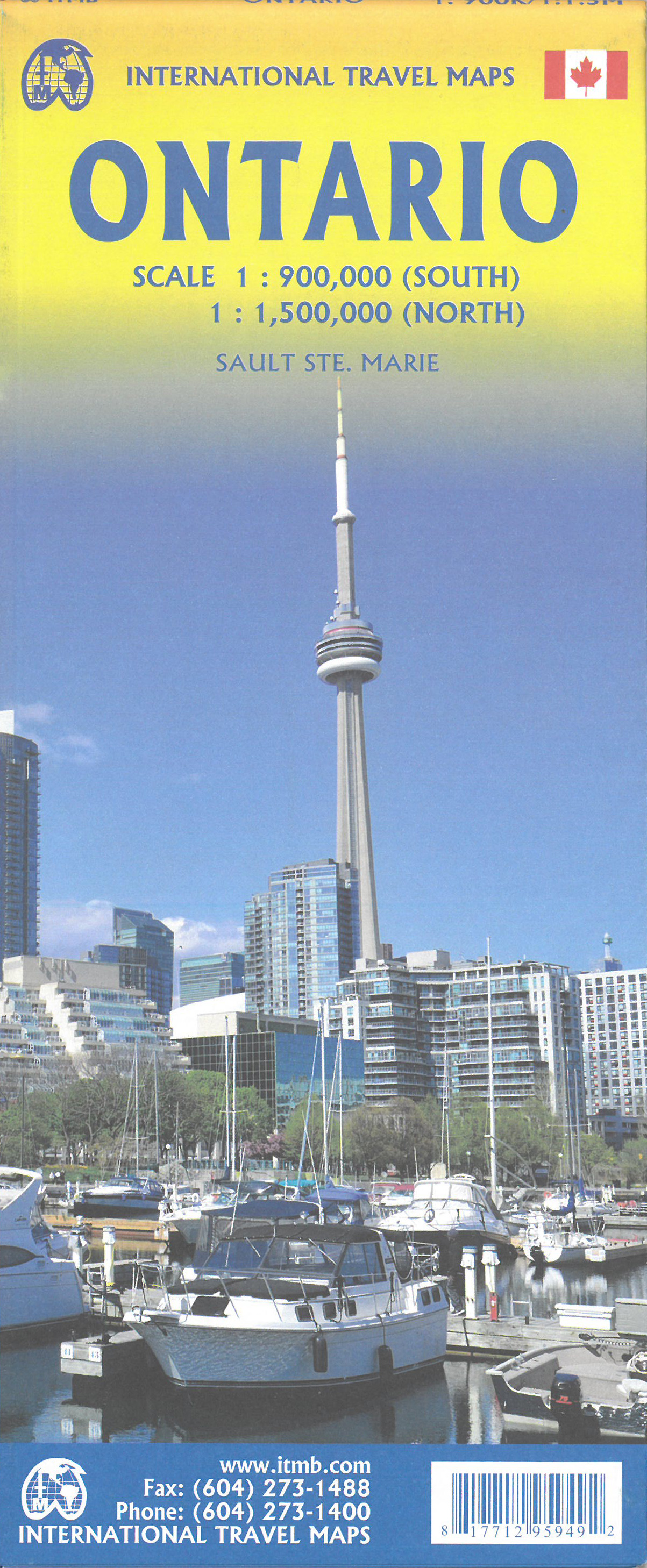
Een degelijke kaart voor Ontario met aanduidingen van o.a. nationale parken, vliegveld, benzinepomp, dirt-roads en kleine plattegrond van Toronto, Sault Ste. Marie. Als overzichtskaart goed te gebruiken.

Ontario and Quebec form the portion of Canada known as Central Canada. Ontario is the industrial heartland of the country, and the southern portion is the most densely-populated and urbanized part of Canada. Toronto is a city of 2.8M people and the heartland of an economic region serving 100,000,000 people in two countries. Southern Ontario is also home for six million residents, some of the most historic sites in the country, and major recreational land masses (Algonquin Park, Bruce Trail, Muskoka/Haliburton). Northern Ontario, on the other side of the map, occupies the bulk of the land area of the province, and is dominated by the Canadian Shield (a pre-Cambrian rock formation that is the oldest land on earth, rich in mineral wealth). The North is dominated by recreational activities, wilderness adventures, and mining tours. Ontario also has ports for ocean-going ships in Lake Superior and on James Bay. Very few Canadians have ever been to Polar Bear Provincial Park in the NE. Printed on paper, double-sided.

Double-sided map of Ontario, part of a series of maps of Canadian provinces from the Vancouver-based ITMB, with topography presented by altitude colouring rather than by relief shading. The map divides the province north-south, showing on one side the southern part 1:900,000, and on the reverse northern Ontario at 1:1,500,000.

Topography is indicated by altitude colouring, with spot heights plus graphics for marshlands. Plenty of rivers and lakes are shown, with the larger ones also named. Numerous national parks or provincial protected areas are highlighted and Indian reservations are marked.

The map shows the province’s road and rail networks, also indicating local airports in remote areas. Symbols highlight campsites, skiing areas, etc. The map has a latitude and longitude grid at intervals of 1º and is indexed


€ 23.95
Reisgids Kenya - Kenia | Lonely Planet

De perfecte reisgids voor zowel de georganiseerde als de zelfstandige reiziger. Naast een algemene inleiding van het land / streek vol met praktische informatie over hoe je er het beste kunt reizen: slapen, eten, vervoer, excursies ... alles kun je er in vinden. Engelstalig. Lonely Planet

Lonely Planet's Kenya is our most comprehensive guide that extensively covers all the country has to offer, with recommendations for both popular and lesser-known experiences. Gaze at a million wildebeest migrating across Masai Mara; get close to big cats; or hike through the national parks; all with your trusted travel companion. Inside Lonely Planet's Kenya Travel Guide: Lonely Planet's Top Picks - a visually inspiring collection of the destination's best experiences and where to have them Itineraries help you build the ultimate trip based on your personal needs and interestsLocal insights give you a richer, more rewarding travel experience - whether it's history, people, music, landscapes, wildlife, politics Eating and drinking - get the most out of your gastronomic experience as we reveal the regional dishes and drinks you have to try Safari Planner Adventure Sports Planning feature Toolkit - all of the planning tools for solo travellers, LGBTQIA+ travellers, family travellers and accessible travel Colour maps and images throughoutLanguage - essential phrases and language tips Insider tips to save time and money and get around like a local, avoiding crowds and trouble spots Covers Nairobi, Southeastern Kenya, Mombasa and the South Coast, Lamu and the North Coast, Southern Rift Valley, Masai Mara and Western Kenya, Central Highlands and Laikipia, Northern Kenya, and more About Lonely Planet: Lonely Planet, a Red Ventures Company, is the world's number one travel guidebook brand.


Providing both inspiring and trustworthy information for every kind of traveler since 1973, Lonely Planet reaches hundreds of millions of travelers each year online and in print and helps them unlock amazing experiences. Visit us at lonelyplanet.com and join our community of followers on Facebook (facebook.com/lonelyplanet), Twitter (@lonelyplanet), Instagram (instagram.com/lonelyplanet), and TikTok (@lonelyplanet). 'Lonely Planet.


It's on everyone's bookshelves; it's in every traveler's hands. It's on mobile phones. It's on the Internet.


It's everywhere, and it's telling entire generations of people how to travel the world.' Fairfax Media (Australia)


€ 24.95
Wegenatlas Official Roadatlas of Ireland - Ierland | Ordnance Survey Ireland

Mooie atlas met bijzonder kleurgebruik. Hoogte wordt hierdoor zeer duidelijk weergegeven. Met alle noodzakelijke en toeristische informatie, afstandentabel, stadsplattegronden en register . In ringband uitgevoerd tussen A4 en A5 qua formaat.

This road atlas contains detailed road maps of the whole of Ireland. In addition it also contains City and Town Maps, Touring and Motoring information, a distance chart, full gazetteer and the location of every Golf Union of Ireland golf course.

€ 15.50
Reisgids Norwegen: Nordkap-Route - Noorwegen Noordkaap | Conrad Stein Verlag

Goede beschrijving van deze (auto)route door heel Noorwegen; van Oslo tot de Noordkaap. Met alle benodigde praktische informatie, tips en foto's.

Die Europastraße 6 ist die nördlichste Traumstraße Europas. Sie führt zusammen mit der E 69 von Oslo zum nördlichsten Punkt des Kontinents, zum Nordkap. Mehr als 2.000 km geht es auf der gut ausgebauten Straße mit unzähligen Sehenswürdigkeiten: durch das Dovrefjell, nach Trondheim, zum Saltstraumen, dem größten Gezeitenstrom der Welt, über den Polarkreis, zu 6.000 Jahre alte Felszeichnungen in Alta, nach Hammerfest, der nördlichsten Stadt der Welt; und natürlich zum Nordkap, wo die Sonne im Sommer nicht untergeht. Nicht zu vergessen die unzähligen Wasserfälle, die phantastische Bergkulisse der Fjorde, unendliche Waldgebiete, kalbende Gletscher und enge Flußtäler, die eine Fahrt nie langweilig werden lassen. Das Buch nimmt die Suche nach Campingplätzen, günstigen Tankstellen sowie Geschäften ab. Zusätzlich beschriebene "Extratouren" abseits der E 6 vertiefen das Norwegenerlebnis und sorgen für Abwechslung bei der Rückfahrt.

€ 19.90
Reisgids Korfu - Korfoe | Michael Müller Verlag

Uitstekende, diepgaande reisgids over Korfoe. Met veel achtergrondinformatie en ook praktische zaken als overnachtingen en eet- en drinkgelegenheden. Thematische hoofdstukken over geschiedenis, geologie etc. Let op: Duits!

Die einen kommen wegen der traumhaften Strände, die anderen wegen der für griechische Verhältnisse außergewöhnlich üppigen Vegetation. Die einen lieben die Ruhe der stillen Bergdörfer, die anderen die trubelige Inselhauptstadt mit ihrer venezianisch geprägten, verwinkelten Altstadt, den originellen Läden und dem aufregenden Nachtleben …

Es gibt viele Gründe, die für Korfu sprechen. Und das schon seit langem, denn die größte Insel im Ionischen Meer ist einer der absoluten Reiseklassiker in Europa. Schon Kaiserin Sisi ließ sich auf ihrer Trauminsel das Schloss Achilon als opulente Sommerresidenz ausbauen.

Nicht überliefert ist, ob sie auch die kleinen Schwesterinseln von Korfu besucht hat. Gefallen hätte es ihr bestimmt, denn das friedliche Paxos und das winzige Antipaxos mit einem der schönsten Strände Westgriechenlands sind auf jeden Fall einen Tagesausflug wert.

€ 21.95
Wandelgids 8-10 Dolomiten-Höhenwege 8-10 (Dolomieten) | Rother Bergverlag

Der Band "Dolomiten-Höhenwege 8-10" wurde grundlegend aktualisiert und überarbeitet. Es handelt sich dabei um vorwiegend leichte, teils aber auch anspruchsvolle Steige, die in 13 bis 18 Tagesetappen durch ständig wechselnde Landschaften und gewaltige Hochgebirgsszenerien mit eindrucksvollen Fernblicken führen: Der 160 km lange Höhenweg Nr. 8 bringt den Wanderer von Brixen nach Salurn, durchquert also von Norden nach Süden die westlichen Dolomiten mit Schlern und Rosengarten. Höhenweg Nr. 9 (180 km) verläuft von Bozen über Cortina d'Ampezzo nach Santo Stefano im oberen Piavetal und bildet somit eine von West nach Ost verlaufende Transversale durch vier Untergruppen der westlichen (Rosengarten, Schlern, Langkofel, Sella) und sieben Teilgebiete der östlichen Dolomiten (u.a. Fanis, Tofanen, Cristallo und Sextener Dolomiten). Ebenfalls in Bozen beginnt der Höhenweg Nr. 10 und führt von dort außerhalb der "eigentlichen" Dolomiten, aber durch die spektakuläre Brenta, bis zum Gardasee. Er ist im Hinblick auf Orientierungs- und Durchhaltevermögen einer der anspruchsvolleren Höhenwege - vor allem im Süden durchquert der Wanderer vielfach einsames, unerschlossenes Bergland - und mit 200 km auch der längste. Die Unterkunft kann bei allen Höhenwegen überwiegend in bewirtschafteten Hütten erfolgen, die Wege sind meist gut markiert.

Alta Via = Höhenweg.

Alta Via nr. 8: Bressanone - Salorno, 160km, 13 etappes;

Alta Via nr. 9: Bolzano - Santo Stefano, 180km, 14 etappes;

Alta Via nr. 10: Bolzano - Lago di Garda, 200km, 18 etappes.

AV-8 en -9 zijn relatief eenvoudig, AV-10 weer iets pittiger. (Van alle tien routes zijn 1, 2, 8 en 9 relatief eenvoudig; routes 3 t/m 7 oplopend in moeilijkheidsgraad.) Gedetailleerde routebeschrijvingen, overnachtingsinformatie (met berghutten) en (eenvoudige) kaartjes.

Voorzien van praktische informatie en kaartmateriaal. Duits

€ 12.95
Reisgids Pocket Florence en Tuscany - Toscane | Lonely Planet

Kleinere uitvoering van de klassieke Lonely Planet gids. Speciaal voor steden in het leven geroepen om in een wat kleinere gids op dezelfde manier alle noodzakelijke informatie op praktische en cultureel gebied te kunnen geven. Zowel voor de georganiseerde als voor de zelfstandige reiziger een uitstekende gids boordevol infomatie. Met uitklapkaartjes.

Lonely Planet's Pocket Florence and Tuscany is your guide to the region's best experiences and local life - neighbourhood by neighbourhood. Marvel at Florence's Duomo, climb the Leaning Tower of Pisa and get back to nature in Chianti; all with your trusted travel companion. Uncover the best of Florence and Tuscany and make the most of your trip! Inside Lonely Planet's Pocket Florence and Tuscany:Full-colour maps and travel photography throughoutHighlights and itineraries help you tailor a trip to your personal needs and interestsInsider tips to save time and money and get around like a local, avoiding crowds and trouble spotsEssential info at your fingertips - hours of operation, phone numbers, websites, transit tips, pricesHonest reviews for all budgets - eating, sightseeing, going out, shopping, hidden gems that most guidebooks missUser-friendly layout with helpful icons, and organised by neighbourhood to help you pick the best spots to spend your timeCovers Florence, Pisa, Siena, Fiesole, Lucca, Chianti and more The Perfect Choice: Lonely Planet's Pocket Florence and Tuscany, an easy-to-use guide filled with top experiences - neighbourhood by neighbourhood - that literally fits in your pocket.


Make the most of a quick trip to Florence and Tuscany with trusted travel advice to get you straight to the heart of the city. Looking for a comprehensive guide that recommends both popular and offbeat experiences, and extensively covers all of Florence and Tuscany's areas? Check out Lonely Planet's Florence and Tuscany regional guide. Looking for more extensive coverage? Check out Lonely Planet's Italy guide for a comprehensive look at all that the country has to offer.


About Lonely Planet: Lonely Planet is a leading travel media company, providing both inspiring and trustworthy information for every kind of traveller since 1973. Over the past four decades, we've printed over 145 million guidebooks and phrasebooks for 120 languages, and grown a dedicated, passionate global community of travellers. You'll also find our content online, and in mobile apps, videos, 14 languages, armchair and lifestyle books, ebooks, and more, enabling you to explore every day.


'Lonely Planet guides are, quite simply, like no other.' New York Times 'Lonely Planet. It's on everyone's bookshelves; it's in every traveller's hands. It's on mobile phones.


It's on the Internet. It's everywhere, and it's telling entire generations of people how to travel the world.' Fairfax Media (Australia)

€ 22.50
Reisgids Fiji | Lonely Planet

De perfecte reisgids over Fiji, voor zowel de georganiseerde als de zelfstandige reiziger. Naast een algemene inleiding van de eilandjes, vol met praktische informatie over hoe je er het beste kunt reizen: slapen, eten, vervoer, excursies ... alles kun je er in vinden. Engelstalig. Lonely Planet.

Set your internal clock to ‘Fiji time’: exploring the archipelago’s exquisite beaches, undersea marvels, lush interiors and fascinating culture shouldn’t be rushed. Lonely Planet will get you to the heart of Fiji, with amazing travel experiences and the best planning advice.

Lonely Planet Fiji is your passport to the most relevant, up-to-date advice on what to see and skip, and what hidden discoveries await you. Say bula to the locals at a dance ceremony; trek to hidden waterfalls on 'Garden Island' Taveuni or ride a bamboo raft through the Namosi Highlands; all with your trusted travel companion. Get to the heart of Fiji and begin your journey now!


Inside Lonely Planet Fiji:


Colour maps and images throughout

Highlights and itineraries help you tailor your trip to your personal needs and interests

Insider tips to save time and money and get around like a local, avoiding crowds and trouble spots

Essential info at your fingertips - hours of operation, phone numbers, websites, transit tips, prices

Honest reviews for all budgets - eating, sleeping, sight-seeing, going out, shopping, hidden gems that most guidebooks miss

Cultural insights give you a richer, more rewarding travel experience - history, environment, culture, traditional lifestyles

Over 35 maps


Covers: Nadi, Suva, Viti Levu, Mamanuca Islands, Yasawa Islands, Ovalau, Lomaiviti Islands, Vanua Levu, Taveuni, Kadavu Islands, Lau Islands, Moala Islands and more


€ 18.50
Wandelgids 4 Dolomiten 4 - Fassatal | Rother Bergverlag

Uitstekende wandelgids van de Dolomieten met 50 dagtochten in dal en hooggebergte. Met praktische informatie en beperkt kaartmateriaal! Wandelingen in verschillende zwaarte weergegeven in rood/blauw/zwart.

Der Dolomitenwanderer, der seinen Urlaub in diesem Gebiet verbringt, will und kann zweierlei: einerseits die Bergwelt rund um seinen Aufenthaltsort erwandern und kennenlernen, andererseits nach Lust und Laune auch seinen sonstigen Interessen frönen und die Annehmlichkeiten der Zivilisation genießen. Im Bereich des Gadertales und seiner Seitentäler eröffnet sich ihm ein überreiches Betätigungsfeld: märchenhaft schöne Lärchen- und Wiesenbezirke zwischen den Felskolossen, abgrundtiefe Schluchten, malerische Täler, verträumte Bergseen, Schutzhäuser, prächtige Aussichtspunkte und auch leicht erreichbare Gipfel.
Der ausgezeichnete Dolomitenkenner Dr. Franz Hauleitner beschreibt in diesem vierten Band der Dolomiten-Wanderführer 50 Touren aus dem Bereich des Fassatales und seiner Seitentäler, darunter die Berggebiete Marmolada, Sella, Langkofel, Rosengarten und Latemar. Im Mittelpunkt steht die ladinische Talschaft Fassa mit ihren attraktiven Sommer- und Wintersportorten Moèna, Vigo, Pozza, Campitello und Canazei. Sie gehört zu den besterschlossenen und meistbesuchten des gesamten Dolomitenraumes.
Alle beschriebenen Touren sind unschwierig und folgen gut bezeichneten Wegen. Sie können auch von weniger trainierten Bergfreunden, zum Teil auch von Kindern und älteren Menschen unternommen werden. Jeder Wandervorschlag wird durch eine farbige Abbildung sowie ein Wanderkärtchen im Maßstab 1: 50 000 bzw. 1: 75 000 mit Routeneintrag illustriert.


€ 22.95
Reisgids Estonia (Estland), Latvia (Letland) & Lithuania (Litouwen) | Lonely Planet

De perfecte reisgids voor zowel de georganiseerde als de zelfstandige reiziger. Naast een algemene inleiding van het land / streek vol met praktische informatie over hoe je er het beste kunt reizen: slapen, eten, vervoer, excursies ... alles kun je er in vinden. Engelstalig. Lonely Planet.

A land of crumbling castles, soaring dunes, enchanting forests and shimmering lakes – a trip to the Baltics proves that fairy tales do come true. Lonely Planet is your passport to Estonia, Latvia & Lithuania, with amazing travel experiences and the best planning advice.


Imagine medieval life in Tallinn’s fairy-tale old town, recharge your batteries at Curonian Spit, or feast on art nouveau architecture in Rīga; all with your trusted travel companion. Get to the heart of Estonia, Latvia & Lithuania and begin your journey now!


Inside Lonely Planet’s Estonia, Latvia & Lithuania Travel Guide:


Full-colour maps and images throughout

Highlights and itineraries help you tailor your trip to your personal needs and interests

Insider tips to save time and money and get around like a local, avoiding crowds and trouble spots

Honest review for all budgets - eating, sleeping, sight-seeing, going out, shopping, hidden gems that most guidebooks miss

Cultural insights give you a richer, more rewarding travel experience – art, history, architecture, environment

Coverage includes: Estonia, Helsinki Excursion, Latvia, Lithuania, Kaliningrad Excursion and more


Abonneer op