€ 11.50
Fietskaart Fietsnetwerk De Kust | Tourisme Vlaanderen

Het fietsnetwerk Kust staat garant voor bijna 600 kilometer fietsplezier aan de Vlaamse Kust. De Vlaamse Kust heeft alle troeven in huis om het als fietsregio voor de vier seizoenen te maken. De oneindige weidsheid van de Noordzee is op zich al een reden voor een bezoek. 

Bijna 67 kilometer zandstranden en 75 bewaakte badzones liggen er aan uw voeten. Laat een zeebries je verkoelen en een duwtje in je rug geven terwijl je op de dijk fietst. Al even uniek en verrassend rijk en gevarieerd zijn de natuurlandschappen aan de Kust. 


Ruim 3600 hectare duinen, waarvan het grootste deel toegankelijk, waken over de verdediging van de kustlijn. De 86 kilometer lange kustfietsroute biedt je een staalkaart van de natuurpracht en de badplaatsen langs de Vlaamse Kust. Maar ook de kustpolders achter de duinen zijn een waar fietsparadijs.

€ 14.95
Kaartentas Dokumententas A6 | Ortlieb

Om op koers te blijven. De kaartentas is aan beide zijden doorzichtig en beschermt uw onontbeerlijke oriëntatiemateriaal tegen vocht, vuil, UV-stralen en omknikken. Bij het wandelen, deltavliegen, kanoën en biken om de hals gehangen of aan de vier bevestigingspunten aan de rugzak vastgemaakt.


Kaartentas A6

• Waterdichte rolsluiting met klittenband

• Omhangkoord met 2 koordstoppers

• 11 cm bij 15 cm

€ 13.50
Wegenkaart - landkaart - Fietskaart 7 Crete - Kreta | Terrain maps

Gedetailleerde wegenkaart en wandelkaart met alle kleine wegen, wandelpaden, hoogtelijnen en toeristische informatie aangegeven. Alle tekst is tweetalig in Engels en Grieks en de waterproof kaart is geschikt voor gebruik met GPS.


The ideal map for planning your trip, as well as the journey itself – if you belong to the 99% of the island’s visitors, who have no intention whatsoever to take the narrowest dirt path leading to the remotest beach of the island! This map is very practical, at a scale of 1:200.000 which allows for a detailed presentation of the road network and sights without the exhaustive detail only the travelers – explorers are interested in. 


We made this map based on our archival series of 1:100.00 Crete maps. We omitted all secondary dirt roads and loads of other unnecessary little roads, magnified the symbols and width of the roads for better visibility, and made colors more vibrant. All this makes for the best general map of Crete on the market! 


Naturally, we have included detailed maps of Crete’s four large cities, on which, among other things, we have marked all hotels. 


A detailed alphabetical index of locations is also incorporated. Crete’s most important sights are depicted on the map in yellow, but we assigned Stephanos Psimenos (author of the travel guide ‘Unexplored Crete’) with compiling a list of the top 20 sights and basic information about them. Last but not least, like all of TERRAIN’s large maps, this one is also printed on Polyart ‘paper’, which is rip-proof and 100% waterproof!

€ 11.95
Wandelkaart 341 Symi | Terrain maps

Gedetailleerde wegenkaart en wandelkaart met alle kleine wegen, wandelpaden, hoogtelijnen en toeristische informatie aangegeven. Alle tekst is tweetalig in Engels en Grieks en de waterproof kaart is geschikt voor gebruik met GPS.

This is a great map because:

For starters, it is the only map of Symi! No other cartographer had bothered creating a map of this remote Greek island in the Dodecanese … Finally, TERRAIN and SKAI created the first reliable map of Symi using GIS technology. 

It is waterproof and rip-proof. You can fold and unfold it a thousand times, fold it in irregular ways, dunk it in the sea or leave it out in the rain. This map is indestructible! 

It is remarkably detailed, as the 1:20.000 scale makes everything crystal clear! 

It is the first time the island’s entire coastline is mapped. Cartography was done with TERRAIN’s specially equipped and staffed cartographic vessel. This means that you can locate all beaches of the island, down to the tiniest cove! In fact, the special features of every single beach are recorded: whether it is sandy or pebbled, whether it features natural tree shade, water, a beach bar or organized water sports, whether the seabed in front of the beach is sandy or rocky (so that you will know where to anchor). 

It features a complete road network. Every road, down to the last dead-end dirt road, is featured in the map of Symi with topographic precision. 

It features the trails of Symi for the first time, with total precision since the cartographers of TERRAIN walked them one-by-one. The length of all trails is measured in kilometers, allowing you to estimate the duration of your hike, plus detailed descriptions of the 10 most important trails of Tilos are featured on the back. 

It indicates the boundaries of NATURA 2000 areas so that you will know which parts of the island are of special environmental interest and beauty – thus you can enjoy traveling through them, but also take care to protect them.

€ 24.95
Reisgids Oezbekistan - Uzbekistan | Bradt Travel Guides

Als er geen Lonely Planet is, is dit het alternatief ... En vaak nog beter ook. De beste gids over Oezbekistan met alle mogelijke informatie, zowel praktisch (eten, slapen, reizen) als achtergronden over cultuur, landschap en bevolking.

Written and updated by expert authors who have extensive experience of living and working in Central Asia, this new, fully updated third edition of Bradt's Uzbekistan remains the definitive and only standalone practical travel guide to this increasingly liberal destination - central Asia's most populous country and the heart of the Silk Road. Offering more detail for independent travellers than any other guidebook, it includes first-hand descriptions of everything from UNESCO world heritage sites and the world's best collection of Russian avant-garde art, to riding across deserts by camel and cooking plov.


The quintessential Silk Route destination, Uzbekistan is opening up to tourism, easing visa regulations, encouraging family-owned guesthouses, building new railways (including a tunnel to the Fergana Valley) and introducing high-speed trains. With the passing of the post-Soviet strongman Islam Karimov and the election of a more reformist leader, there is an air of change about the country.


This new edition includes expanded coverage of hiking, details of new entertainment such as the sound and light show in the Registan in Samarkand, and lots of new practical information, ranging from the increasing availability of ATMs to efforts to develop tourism, visa requirements, availability of SIM cards, haggling for taxis, access to museums and booking accommodation. New maps have also been added and existing maps revised and expanded as appropriate.


Whether you're interested in culture, trekking, historical sites, archaeology and architecture, seeing endless deserts or the majestic mountainscapes of the Tien Shan range, or simply fascinated by the golden road to Samarkand and the equally famous Silk Road cities of Bukhara and Khiva, Bradt's Uzbekistan is the ideal companion.


€ 19.99
Wandelgids La Gomera | Uitgeverij Elmar

Let op: er is enige verwarring omtrent het jaartal van deze Nederlandse wandelgidsen van uitgever Elmar. Dit is een vertaling van de Duitse uitgever Rother maar daarna NIET bijgewerkt. De datum die wij vermelden is het moment van vertaling; er zijn andere – meer recente jaartallen – in omloop maar dat is de datum van een nieuwe druk ZONDER aanpassingen. Wilt u de meest recente wandelgids van dit gebied van deze uitgever: kies dan de Duitstalige versie van uitgever Rother. Deze zijn recent en WEL bijgewerkt. 


De Rother Wandelgids La Gomera beschrijft 53 wandelroutes voor dit populaire Canarische Eiland.


Wandel in de schaduw van de 1487 meter hoge Garajonay, geniet van de verbluffend mooie uitzichten en rust uit tussen de laurierbomen. Niet voor niets is Nationaal park Garajonay door UNESCO aangewezen als wereldnatuurerfgoed.


Alle dagwandelingen hebben betrouwbare routebeschrijvingen, gedetailleerde wandelkaarten en hoogteprofielen. 


De GPS-tracks van de Rother Wandelgids La Gomera zijn te downloaden op de website van Uitgeverij Elmar.

€ 17.50
Reisverhaal Indonesië | Dolf de Vries

Schrijver en acteur (Soldaat van Oranje, Zwartboek) Dolf de Vries neemt u in Indonesië mee naar dit mysterieuze land. Hij begint in Jakarta en reist naar de groene regenwouden van Kalimantan (Borneo), naar het schitterende Masarang-gebergte van Sulawesi (Celebes) en naar kleinere Molukse eilanden. In zijn geheel eigen persoonlijke stijl Ð met vooral oog voor de mensen maar ook voor de geschiedenis en de cultuur beschrijft hij zijn reis over de grote en kleine eilanden van deze kleurrijke archipel. Dit boek is een feest voor wie dit land wil bezoeken, wie er al eens is geweest en wie gewoon thuis iets te weten wil komen over Indonesië. Van Indonesië zijn meer dan 10.000 exemplaren verkocht.

€ 11.95
Wandelkaart 316 Folegandros | Terrain maps

Gedetailleerde wegenkaart en wandelkaart met alle kleine wegen, wandelpaden, hoogtelijnen en toeristische informatie aangegeven. Alle tekst is tweetalig in Engels en Grieks en de waterproof kaart is geschikt voor gebruik met GPS.

This is a great map because:

First and foremost, it’s the only existing GIS map of Folegandros, which makes it the only truly accurate and GPS compatible map of the island. 

It comes in the detailed scale of 1:20,000, showing everything with great clarity, and it is made with data collected 100% through field survey. 

The entire trail network of Folegandros is shown for the first time, with impeccable accuracy. All trails are measured in kilometers, so you can estimate the duration of your hike. On the back side, the island’s 5 best hikes are presented in detail. These are also distinctly labeled on the map so you can easily locate them. 

It is printed on Polyart material, making it totally waterproof and rip-proof. You can fold it and unfold it a hundred times, fold it in irregular ways, dunk it in the sea or leave it out in the rain. This map is indestructible! The island’s entire coastline is mapped for the first time with TERRAIN’s specially equipped and staffed cartographic vessel. This means that you can locate all beaches of the island, down to the tiniest cove! In fact, the special features of every single beach are recorded: whether it is sandy or pebbled, whether it features natural tree shade, water, a beach bar or organized water sports, whether the seabed in front of the beach is sandy or rocky (so that you will know where to anchor). 

It indicates the boundaries of NATURA 2000 areas so that you will know which parts of the island are of special environmental interest and beauty – thus you can enjoy traveling through them, but also take care to protect them. • It features a detailed plan of the island’s capital (1:2,000 scale) and indicates hotel sites, so you can easily locate them. Also, the reverse side features an illustrated mini travel guide, with information on the island’s myths and history, geography and natural environment, sights and major attractions.


€ 11.95
Wandelkaart 301 Tzia ( Kea ) | Terrain maps

Erg goede wandelkaart van Tzia, weerbestendig en volledig. Bezienswaardigheden, campings en andere praktische zaken staan op de kaart aangegeven. GPS toepasbaar.

This is the best map of Tzia because:

It is waterproof and rip-proof. You can fold and unfold it a thousand times, fold it in irregular ways, dunk it in the sea or leave it out in the rain. This map is indestructible!

It is the first time the island’s entire coastline is mapped. Cartography was done with TERRAIN’s specially equipped and staffed cartographic vessel. This means that you can locate all beaches of the island, down to the tiniest cove! In fact, the special features of every single beach are recorded: whether it is sandy or pebbled, whether it features natural tree shade, water, a beach bar or organized water sports, whether the seabed in front of the beach is sandy or rocky (so that you will know where to anchor).

It indicates the boundaries of NATURA 2000 areas so that you will know which parts of the island are of special environmental interest and beauty – thus you can enjoy traveling through them, but also take care to protect them.

It features the most complete road network. The dirt road descending to the bay of Schinos, the dirt road crossing the oak forest south of Ioulidha toward the chapel of Aghios Georghios, and the roads in the area of Koundhouros are just a few of the roads appearing in a map of the island for the first time. It features biking routes through the prettiest remote dirt roads on the north and south of the island, for mountain bike fans, and detailed descriptions of 10 hiking trails on the back.

€ 15.50
Wandelgids Hikeline Schwäbische Alb Ost | Esterbauer

Handzame gids met een goede beschrijving van een groot aantal dagtochten in dit gebied. De gids is in spiraalbinding en elke pagina is op scheur- en watervast papier gedrukt. Daar is echt over nagedacht!

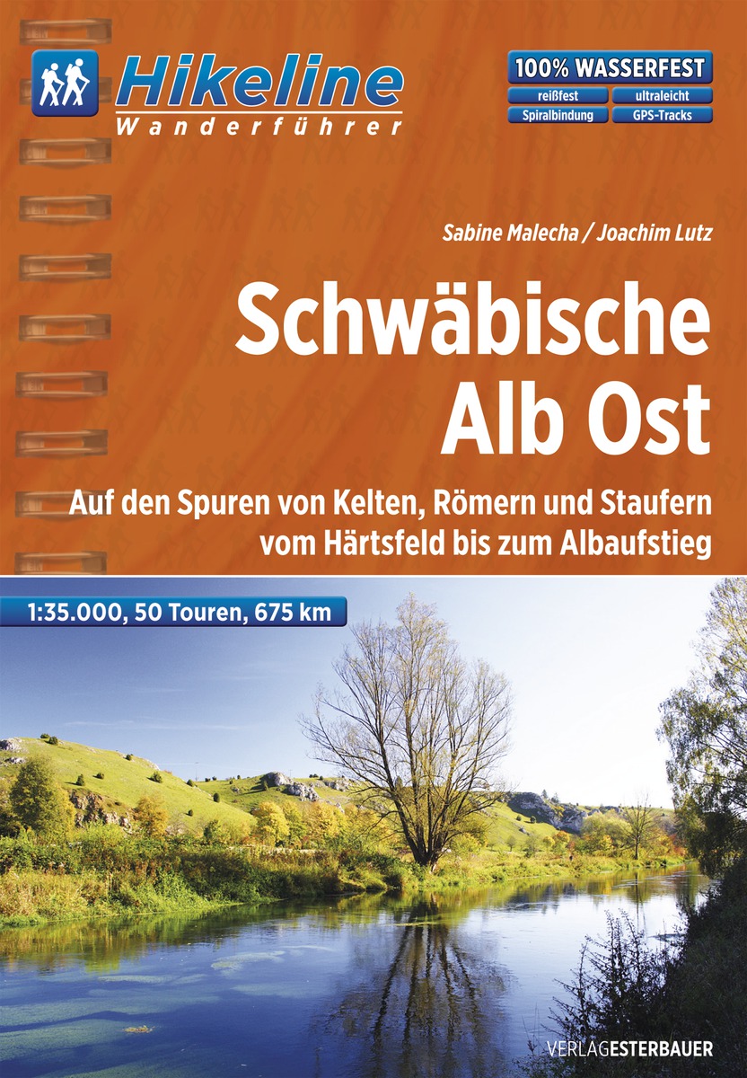
Die Schwäbische Alb Ost ist ein Landstrich voller Gegensätze: raues Klima im Winter und herrliche Sommer- und Herbsttage. Kleine Dörfer und große Bauernanwesen auf der Albhochfläche, sowie größere Städte in den Flusstälern prägen die Landschaft. Schlösser wie Schloss Taxis, Burgen wie die Kapfenburg und Ruinen wie der Hohenstaufen sorgen für Kulturgenuss am Weg. Auch eine der schönsten Barockkirchen Europas, die Abteikirche in Neresheim auf dem Härtsfeld, wird erwandert. Wandern auf der Schwäbischen Alb ist mehr als Bewegung, Abschalten ist hier ganz einfach möglich – ob im idyllischen Eyachtal oder auf dem Eckfelsen. Ein Hauch von Albwachholder in der Nase, „Herrgottsbscheißerle“ und Alblinsen im Magen – die Schwäbische Alb ist eine Region, die man auch schmecken kann. Die andere Hälfte der Schwäbischen Alb, die Westalb können Sie dem Hikeline Wanderführer Schwäbische Alb West erforschen.


Geologie

Im Grunde ist die ganze Schwäbische Alb ein einziger Geologiepark. Hier kann man verschiedene Epochen und Phänomene der Erdgeschichte, die seit über 200 Mio. Jahren andauern, in ihrer ganzen Vielfalt erleben. Vor 180 Millionen Jahren lag das Gebiet der Schwäbischen Alb unter einem warmen Jurameer. Mit dem Schlamm des Meeres lagerten sich auf dem Grund Tier- und Pflanzenreste ab. Vor 135 Millionen Jahren trocknete das Meer dann aus. Im Boden blieben Versteinerungen von Pflanzen und Urtieren erhalten. Faszinierende Fischsaurier, glänzende Goldammoniten, Europas besterhaltene Meteoritenkrater, geheimnisvolle Höhlen oder das einzigartige Besucherbergwerk das sind nur einige geologische Highlights im Gebiet der Schwäbischen Alb Ost.


Flora und Fauna

Typische Vegetationsformen wie beispielsweise Trockenrasen oder Wacholderheiden hängen unmittelbar mit dem geologischen Gesteinsuntergrund zusammen. Die Pflanzenwelt der Schwäbischen Alb ist sehr vielfältig sogar Orchideen wachsen hier. Oben, nach dem Albaufstieg wandern Sie durch Buchen- und Mischwälder und weite Hochflächen. Wiesen und steinige Äcker wechseln sich ab. Der Bergahorn, die Linde und die Esche sind hier heimisch. Auch typische Steingewächse wie Felsenbirne und Felsenmispel. Selbst alpine Pflanzen wie Traubensteinbrech oder Felsenhungerblümchen gibt es. An trockenen Süd- und Südwesthängen gedeiht Fingerhut, Wolfsmilch, Knabenkräutern und Storchschnabel.


Länge, Höhenmeter

Die 50 Touren in diesem Buch decken eine große Bandbreite von kurzen Wanderungen auf einfachen Wegen bis hin zu anspruchsvollen Tagestouren ab. Es sind dabei zwischen 100 und 700 Höhenmeter zu bewältigen. Die angegebenen Gehzeiten verstehen sich lediglich als Richtwerte und liegen zwischen 2 und 7 Stunden. Vor allem die Abschnitte über Treppen sind vom Zeitaufwand sehr schwer einzuschätzen. Also denken Sie bei Ihrer Zeitplanung daran, dass man besonders bei diesen Streckenteilen manchmal eine zusätzliche Pause einlegen muss. Außerdem laden häufig Aussichtspunkte zum längeren Verweilen ein. Schätzen Sie Ihre konditionellen und technischen Fähigkeiten richtig ein und tasten Sie sich schon vor dem Urlaub an Ihre Grenzen heran.


Wegweisung

Die Länge des Wanderwegenetzes des Schwäbischen Albvereins beträgt zurzeit ca. 24.000 Kilometer, die Wege werden von den Ortsgruppen des Schwäbischen Albvereins betreut. Auf der Schwäbischen Alb Ost ist nur der HW 1 prämiert und weist eine lückenlose Markierung auf, ansonsten ist nicht immer mit einer durchgängig auf Sicht ausgerichteten Markierung zu rechnen. Eine Portion Pfadfindergeist und eine Prise Orientierungssinn, dazu dieser Wanderführer werden Ihnen helfen, die Wege zu finden und die Wanderungen zu genießen. Auf vielen vorgestellten Touren finden Sie eine intakte Natur und absolute Ruhe - weit entfernt vom Massentourismus.


Anforderung

Die Schwäbische Alb ist ein Wanderparadies für sportliche Wanderer, Genusswanderer und Spaziergänger. Schmale Pfade, urige Steige wechseln sich mit bequemen Wegabschnitten ab.

Abonneer op