Een rijk geillustreerde reisgids met diepgaande teksten: één van de beste reisgidsen die er bestaan. Eerste deel bestaat uit een beschrijving van de unieke aspecten van de regio, daarna een deel echte reisgids en als afsluiting een deel met praktische informatie. De uitstekende informatie wordt vergezeld van prachtige foto's en heldere kaarten. Niet alleen om mee te nemen, maar ook om vooraf en zelfs achteraf weer in de stemming te komen.
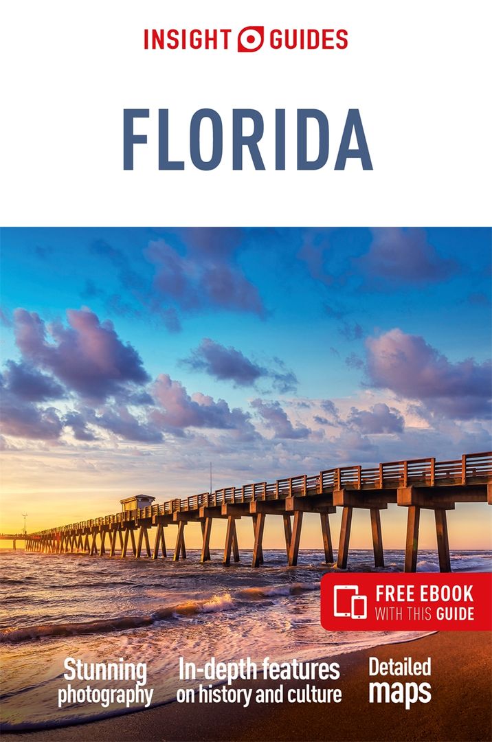
This Insight Guide is a lavishly illustrated inspirational travel guide to Florida and a beautiful souvenir of your trip. Perfect for travellers looking for a deeper dive into the destination's history and culture, it's ideal to inspire and help you plan your travels. With its great selection of places to see and colourful magazine-style layout, this Florida guidebook is just the tool you need to accompany you before or during your trip. Whether it's deciding when to go, choosing what to see or creating a travel plan to cover key places like Palm Beach, Lake Okeechobee, it will answer all the questions you might have along the way. It will also help guide you when you'll be exploring Everglades National Park or discovering Caladesi Island State Park on the ground. Our Florida travel guide was fully-updated post-COVID-19.
The Insight Guide FLORIDA covers: South Florida, Miami, Florida Keys, Atlantic Coast, Central Florida, North Florida.
In this guide book to Florida you will find:
IN-DEPTH CULTURAL AND HISTORICAL FEATURES
Created to explore the culture and the history of Florida to get a greater understanding of its modern-day life, people and politics.
BEST OF
The top attractions and Editor's Choice featured in this Florida guide book highlight the most special places to visit.
TIPS AND FACTS
Up-to-date historical timeline and in-depth cultural background to Florida as well as an introduction to Florida's food and drink, and fun destination-specific features.
PRACTICAL TRAVEL INFORMATION
A-Z of useful advice on everything from when to go to Florida, how to get there and how to get around, as well as Florida's climate, advice on tipping, etiquette and more.
COLOUR-CODED CHAPTERS
Every part of the destination, from Gulf Coast to Miami has its own colour assigned for easy navigation of this Florida travel guide.
CURATED PLACES, HIGH-QUALITY MAPS
Geographically organised text, cross-referenced against full-colour, high-quality travel maps for quick orientation in Daytona Beach, Tampa and many other locations in Florida.
STRIKING PICTURES
This guide book to Florida features inspirational colour photography, including the stunning Fort Lauderdale and the spectacular Kennedy Space Center.
FREE EBOOK
Free eBook download with every purchase of this travel guide to Florida to access all the content from your phone or tablet, for on-the-road exploration.