€ 23.50
Wandelkaart Parque Natural da Arrábida | Adventure MAPS

Prachtige topografische kaart van het Nationale park Arrábida in Portugal.

Schaal: 1:25000 1/25 (1 cm = 250 meter)

Legenda en aanvullende informatie  PT, EN, ES, FR en DE

Magnetisch kompas opgenomen 

Net van toeristische paden (inclusief GR11) 

Toeristische bezienswaardigheden in de omgeving van de symboliek (monumenten, mooie vergezichten, picknickplaatsen, musea en toeristische kantoren)

Klimmen, surfen, duiken, paragliding en de stranden

Offset contouren van 10 m

Gauss rooster met afdelingen van 1 Km

Coördinaten WGS84 (compatibel met GPS)

Vertegenwoordiging van magnetische declinatie

Printing: Duplex
Plaatsen op de kaart
Aldeia do Meco | Alfarim | Azeitão | Cotovia | Lagoa de Albufeira | Palmela | Quinta do Anjo | Quinta do Conde | Sesimbra | Setúbal

€ 21.99
Reisgids Het eiland van Pelops | Amsterdam University Press

Het eiland van Pelops neemt je mee op een literaire (tijd)reis naar het grootste schiereiland van Griekenland: de Peloponnesos. Tekstfragmenten van auteurs en reizigers uit alle eeuwen — met name uit de Klassieke Oudheid maar ook uit latere tijden — bieden een authentieke blik op de bekende en minder bekende plaatsen van dit kleurrijke schiereiland. Hugo Koning en Hans Verheij hebben hiervoor de mooiste literaire en historische fragmenten geselecteerd en schrijven ze in Het eiland van Pelops op een aanstekelijke manier aan elkaar, voorzien van de benodigde contextuele informatie en illustraties.
 
Het boek biedt een verrassende ontdekkingstocht door de vele historische lagen in het palimpsest van het Griekse landschap. De route is uitgestippeld langs uiteenlopende literaire en historische teksten over de Peloponnesos, waarvan sommige speciaal voor dit boek voor het eerst vertaald zijn. Wie de sfeer optimaal wil beleven, leest het boek onder een olijfboom op locatie. Maar je kunt ook op reis vanuit de luie stoel.
 
Nooit drong de rijke geschiedenis van de Peloponnesos beter tot me door dan na het lezen van dit boek.
—Fik Meijer

€ 24.95
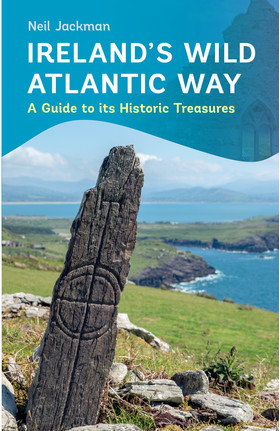
Reisgids Ireland's Wild Atlantic Way - Ierland | The Collins Press

Deze boeiende en praktische gids is een essentiële metgezel voor elke ontdekkingsreiziger die dieper wil graven en dit spectaculaire landschap wil ontdekken.

 
Boasting ancient tombs, atmospheric castles and sacred retreats, the Wild Atlantic Way is alive with treasures to explore.
 
Beginning in Kinsale, Neil Jackman guides us northwards to visit his top 100 heritage sites. From 350-million-year-old footprints on Valentia Island to vestiges of the more recent past like the cottage of 1916 revolutionary Patrick Pearse, you will discover the stories behind the dramatic scenery.
 
Here is everything you need to know about the history of iconic landscapes like the Cliffs of Moher and the Ring of Kerry, as well as lesser-known delights like the monastic site at Reask in County Kerry and the Doonfeeny Standing Stone in County Mayo. For those who want to get off the beaten track, there are trips to islands like Scattery, Inishmurray and, of course, the breathtaking Skellig Michael.
 
This engaging and practical guide is an essential companion for any explorer wishing to dig deeper and discover the gems of this spectacular landscape.

€ 10.50
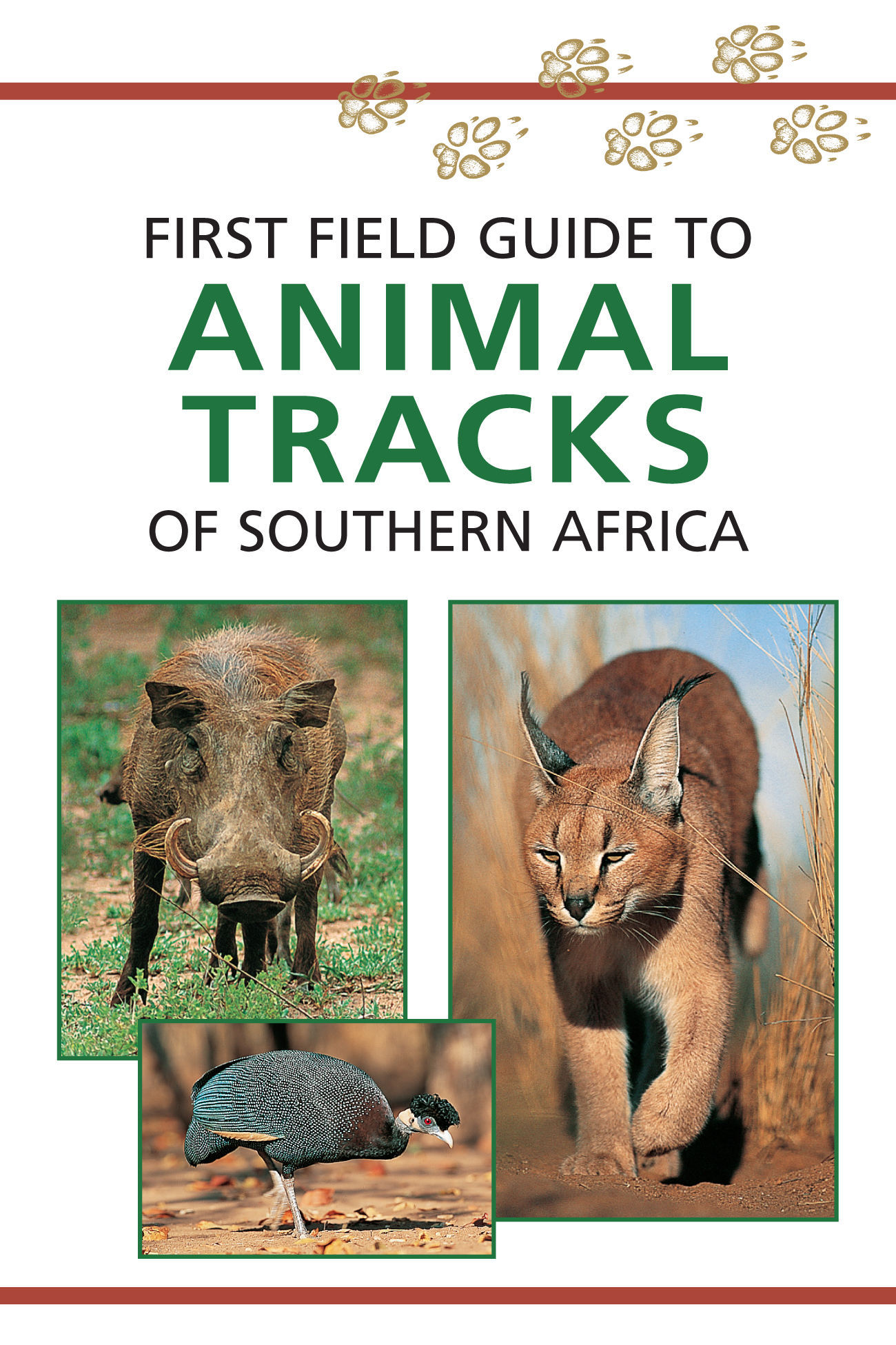
Natuurgids First Field Guide to Animal Tracks of Southern Africa | Str

Dit handzame gidsje is een goed hulpmiddel voor het spotten van de sporen van meest voorkomende dieren in zuidelijk Afrika. Met kleurenfoto's, tekeningen van pootafdrukken en kaartjes van leefgebieden.
The First Field Guide to Animal Tracks of Southern Africa will help to decipher the more common tracks encountered in southern Africa. The animal's spoor may vary according to its age, mass, sex and condition. It may also have a unique way of walking or a particular habit that distinguishes it from other individuals of the same species. People today are often not familiar with the immense variety of animal life that surrounds them, simply because most animals are rarely seen. To a 'spoor conscious' tracker, however, animal tracks may reveal the activities of a multitude of animals. Leopards, for example, are very elusive and thus hardly ever seen. They have the uncanny ability to live near human settlements, often on the periphery of large cities. Finding leopard tracks in unexpected places can be exhilarating. Even if you never see the animal, the knowledge that it is there is immensely gratifying. By reconstructing animal movements from footprints, you may be able to visualise the actions of that animal. In this way a whole story may unfold a story of what happened when no one was looking.
Checklist: First Field Guide to Animal Tracks of Southern Africa
Aardvark, Aardwolf, African Buffalo, African Civet, African Wild Cat, African Wild Dog, Antbear, Bat-eared Fox, Black-backed Jackal, Blue Wildebeest, Burchell's Zebra, Cape, Clawless Otter, Caracal, Chacma Baboon, Cheetah, Common Duiker, Egyptian Goose, Eland, Elephant, Gemsbok, Giraffe, Guineafowl, Hares, Hippopotamus, Honey Badger, Klipspringer, Kori Bustard, Kudu, Leopard, Southern Lesser Galago (Bushbaby), Lion, Meerkat, Mice, Ostrich, Passerines, Porcupine, Rats, Small-spotted Genet, Snakes, Spotted Hyaena, Springbok, Springhare, Steenbok, Striped Polecat, Suricate, Tortoises, Vervet Monkey, Warthog, Water Mongoose and White Rhinoceros.

€ 11.50
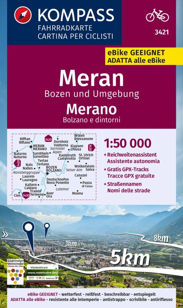
Fietskaart 3421 Meran, Bozen Umgebung | Kompass

Komplete duidelijke fietskaart van het uitdagende deel van de Dolomieten. . Op scheur- en watervast papier staan de fietsroutes helder ingetekend. Daarnaast praktische informatie als campings , fietsenmakers, bezienswaardigheden en topografische details. Veel wordt met symbolen aangeduid. De schaal is goed: 1:70.000 is uitermate geschikt voor fietstochten. 
Die Fahrradkarte die alles kann, das bedeutet: - übersichtliche Kartografie, detailgenaue Infos zu Wegbeschaffenheit und Verkehrsbelastung - handliches Format - passend für den Radkartenhalter - Reichweitenassistenten: Reicht der E-Bike-Akku? Easy Touren-Planung mit dem KOMPASS-Reichweitenassistenten. - Steigungspfeile: Bergauf oder bergab? Die Steigungspfeile zeigen's auf einen Blick. - Gratis-GPX-Tracks: Immer wissen, wo man ist: Mit den Gratis-GPXTracks zum Download auch digital mobil sein. - Extra-Stadtpläne: Mit den extra-detaillierten Stadtplänen keine Sehenswürdigkeit verpassen _ und keinen Biergarten. - Unser reiß- und wetterfestes Papier ist ideal für jede Witterung, spiegelt nicht und ist beschreibbar.. 
Dorpen: Meran, Bozen, Brixen, Naturns (Naturno), Lana, St. Ulrich (Ortisei), Nals (Nalles), Fondo, Mazzin, Vigo di Fassa, Kaltern (Caldaro), Romeno, Livo, Auer (Ora), Latemar, Moena, Predazzo, Male, Neumarkt / Egna, Salurn (Salorno), Cavalese
 
Rivieren: Etsch, Noce, Eisack
 
Regio:  Südtirol, Dolomiten, Ultental (Val Ultimo), Seiser Alm (Alpe di Siusi)

€ 20.95
Reisgids Dordogne & the Lot | Rough Guides

Zeer goede reisgids voor zowel de georganiseerde maar vooral voor de zelfstandige reiziger. Boordevol informatie over reizen, slapen, eten, maar ook musea en cultuur. Voor Europese landen meestal completer en beter dan de Lonely Planet !
This in-depth coverage of the Dordogne & the Lot's local attractions, sights, and restaurants takes you to the most rewarding spots—from castles to châteaus to cathedrals—and stunning color photography brings the land to life on the pages. With a beautiful new cover, amazing tips and information, and key facts, The Rough Guide to The Dordogne & the Lot is the perfect travel companion.
The locally based Rough Guides author team introduces the best places to stop and explore, and provides reliable insider tips on topics such as driving the roads, taking walking tours, or visiting local cathedrals. You'll find special coverage of history, art, architecture, and literature, and detailed information on the best markets and shopping for each area in this fascinating region.
The Rough Guide to the Dordogne & the Lot also unearths the best restaurants, nightlife, and places to stay, from backpacker hostels to beachfront villas and boutique hotels, and color-coded maps feature every sight and listing.

€ 16.50
Fietsgids Bikeline Elbe Radweg - Stromaufwärts | Esterbauer

Praktische fietsgids met detailkaarten, ingetekende route, informatie over overnachten en fietsenmakers, zwaarte en hoogteprofiel. In spiraalbinding, Duitstalig. Van Hamburg tot Bad Schandau, lengte 690 km. Nu met watervaste geplastificeerde kaarten!!
Der etwa 1.220 Kilometer lange Elbe-Radweg zählt zu den beliebtesten Radfernwegen Europas. Im Jahr 2017 wurde er von den Mitgliedern des ADFC zum dreizehnten Mal in Folge zum beliebtesten Radfernweg Deutschlands gewählt. Dieses bikeline-Radtourenbuch trägt dem Wunsch vieler Radfahrer Rechnung, den Elbe-Radweg flussaufwärts zu radeln und somit die vorherrschenden Westwinde als Rückenwind zu nutzen. Die dargestellte Radroute verläuft von der Hansestadt Hamburg bis nach Bad Schandau nahe der tschechischen Grenze, wobei sich der Routenverlauf an der von den Radlern bevorzugten Flussseite orientiert. Am jeweils anderen Ufer ist die Strecke als Variante beschrieben.
Die Gesamtlänge des Hauptradweges beträgt 690 Kilometer. Die Varianten und Ausflüge haben eine Länge von 867 Kilometern.

€ 13.95
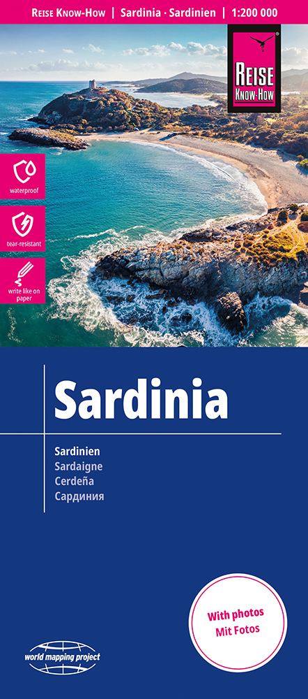
Wegenkaart - landkaart Sardinië | Reise Know-How Verlag

Tweetalige kaart (Engels en Duits). Door ingetekende lengte- en breedtegraden is het gebruik van GPS mogelijk. Met hoogtelijnen en uitgebreid wegennetwerk: daarnaast worden ook de afstanden tussen belangrijke plaatsen duidelijk leesbaar weergegeven. Het kleurgebruik is zodanig dat je een goede indruk krijgt van hoogteverschillen en soorten landschap. Natuurlijk staan de toeristische bezienswaardigheden duidelijk vermeld.
 
Gedrukt op water- en scheurvast papier! Polyart is een synthetisch product vrij van giftige stoffen dus duurzaam. Het papier gaat echt lang mee.
 
Topography is indicated by altitude colouring with numerous spot heights and names of mountain ranges and passes. Salt lakes, swamps, seasonal rivers and glacier are also shown. Detailed presentation of the road network includes minor roads and tracks and railways are also shown.
 
Internal administrative units are presented with their boundaries and names. National parks and other protected areas are highlighted. A wide range of symbols mark various places of interest. Map legends include English and all the maps have an index of localities.

€ 16.90
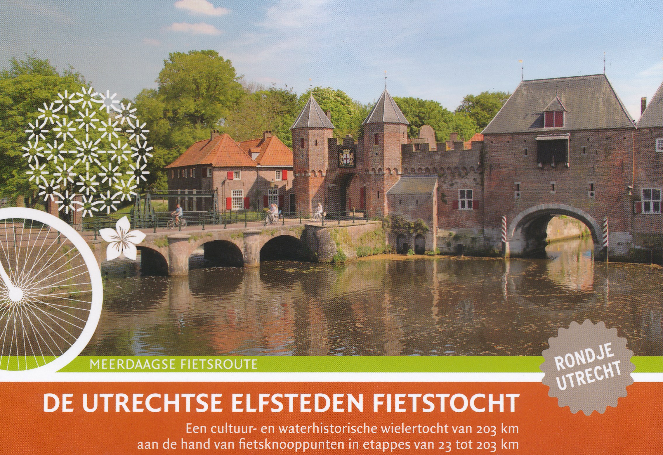
Fietsgids De Utrechtse Elfsteden Fietstocht | Buijten & Schipperheijn

Een fietstocht langs weilanden, akkers, fruitboomgaarden, kastelen, buitenplaatsen, oude boerderijen, door bossen en over zandheuvels, maar vooral door middeleeuwse steden en langs oude rivieren, kanalen en weteringen. Vermelding van kijkpunten, musea, overnachtingsadressen, horeca, winkels en fietsvoorzieningen.

€ 31.95
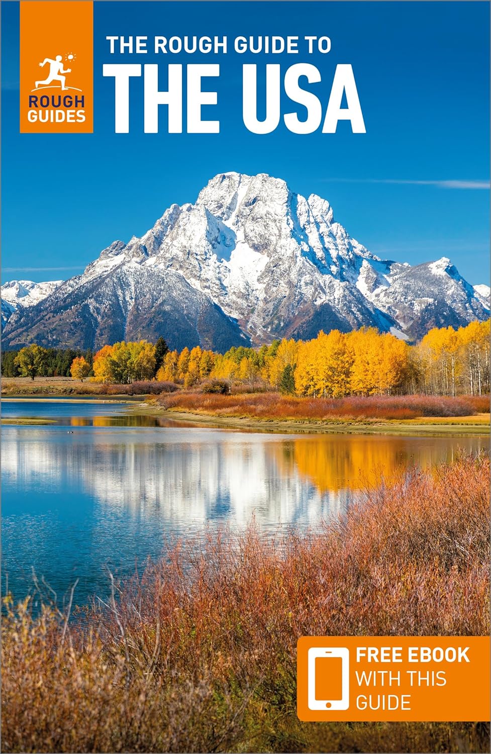
Reisgids USA | Rough Guides

Zeer goede reisgids voor zowel de georganiseerde maar vooral voor de zelfstandige reiziger. Boordevol informatie over reizen, slapen, eten, maar ook musea en cultuur. Uitputtende bron van informatie, veelal nog completer dan de Lonely Planet. Inleidende informatie over land en cultuur is zeer goed.

This USA guidebook is perfect for independent travellers planning a longer trip. It features all of the must-see sights and a wide range of off-the-beaten-track places. It also provides detailed practical information on preparing for a trip and what to do on the ground. And this USA travel guidebook is printed on paper from responsible sources, and verified to meet the FSC's strict environmental and social standards.


This USA guidebook covers: New York City, The Mid-Atlantic, New England, The Great Lakes, The Capital Region, The South, Florida, Louisiana, Texas, The Great Plains, The Rockies, The Southwest, California, The Pacific Northwest, Alaska, Hawaii.


Inside this USA travel book, you'll find:


- A wide range of sights - Rough Guides experts have hand-picked places for travellers with different needs and desires: off-the-beaten-track adventures, family activities or chilled-out breaks

- Itinerary examples - created for different time frames or types of trip

- Practical information - how to get to the USA, all about public transport, food and drink, shopping, travelling with children, sports and outdoor activities, tips for travellers with disabilities and more

- Author picks and things not to miss in the USA - Redwood National and State Parks; Glacier National Park; Sweet Auburn, Atlanta; The National Mall, Washington DC; Walt Disney World, Orlando; Skiing in the Rocky Mountains; Las Vegas, Yellowstone National Park, The Grand Canyon; Hawaii Volcanoes

- Insider recommendations - tips on how to beat the crowds, save time and money, and find the best local spots

- When to go to the USA - high season, low season, climate information and festivals

- Where to go - a clear introduction to the USA with key places and a handy overview

- Extensive coverage of regions, places and experiences - regional highlights, sights and places for different types of travellers, with experiences matching different needs

- Places to eat, drink and stay - hand-picked restaurants, cafes, bars and hotels

- Practical info at each site - hours of operation, websites, transit tips, charges

- Colour-coded mapping - with keys and legends listing sites categorised as highlights, eating, accommodation, shopping, drinking and nightlife

- Background information for connoisseurs - history, culture, art, architecture, film, books, religion, diversity

- Free download of the eBook - available after purchase of the printed guidebook to the USA

- Fully updated post-COVID-19


The guide provides a comprehensive and rich selection of places to see and things to do in the USA, as well as great planning tools. It's the perfect companion, both ahead of your trip and on the ground.

Abonneer op