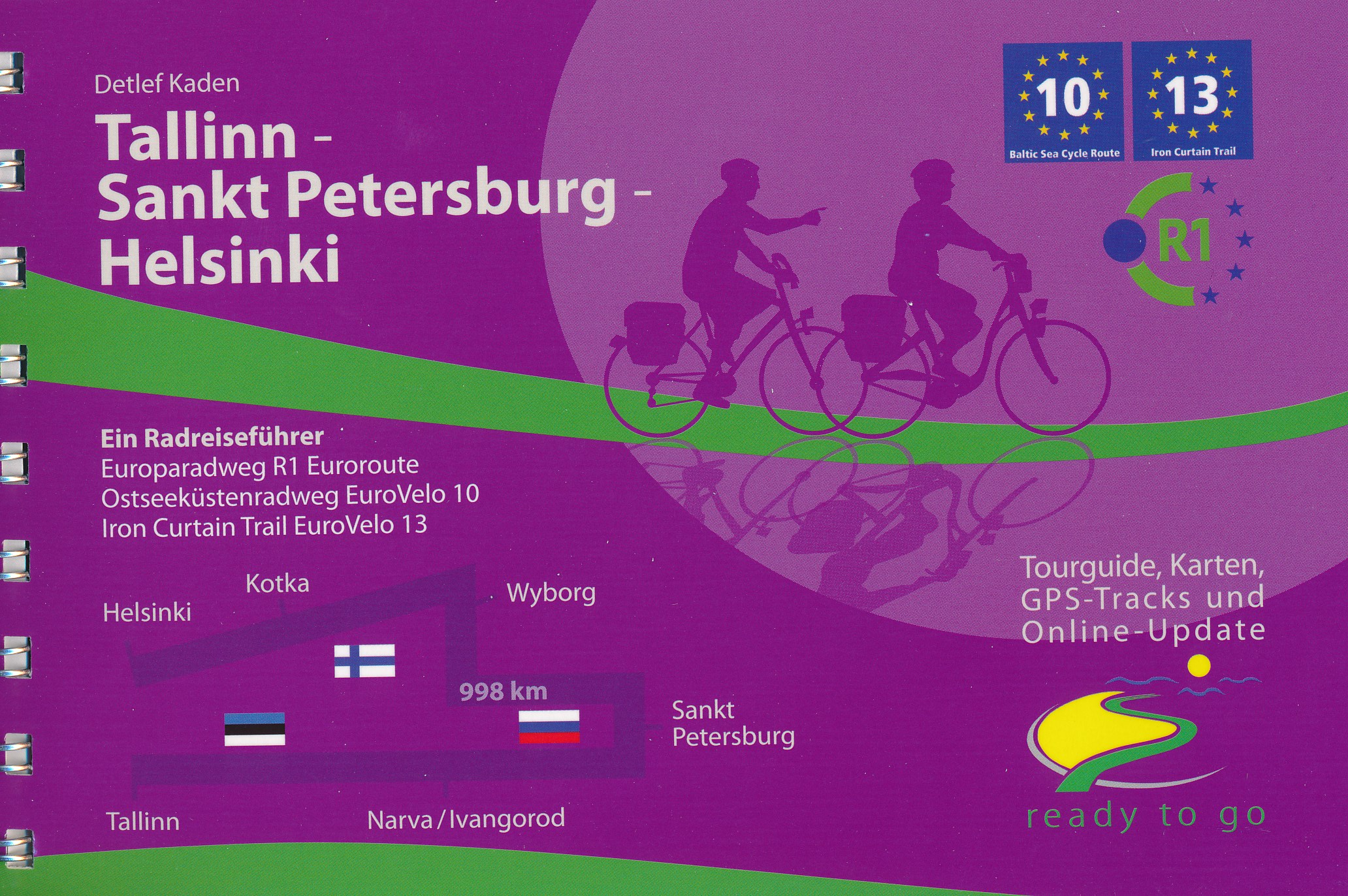
€ 23.50
Reisgids Secret Seville | Jonglez Publishing

Let Secret Seville guide you around the unusual and unfamiliar. Step off the beaten track with this fascinating Seville guide book. Let our local experts show you the well-hidden treasures and hidden places of this amazing city.


Featuring over 170 unusual and unfamiliar places, this Secret Seville guide is ideal for local inhabitants, curious visitors and armchair travellers alike. Why is there a stone relief of Grace Kelly on the wall of Seville Town Hall and how can you track down the railway from the Ibero-American Expo of 1929? Where might you find the legacy of Christopher Columbus’ son, a medieval Jewish cemetery in a car park, the oddest of barbershops, forgotten souvenirs from the Guadalquivir steamboats, Masonic symbols in a church, the last remaining vestiges of the Andalusian pavilions from the ’29 Expo, a little-known Modernist electric power station, an example of the Nazi Enigma machine, a collection of Chinese and Japanese art in a Renaissance mansion or the pillars of a medieval synagogue?Far from the crowds and the well-worn clichés, Seville still has many hidden gems it only reveals to locals and visitors who head off the beaten track.An essential guide for those who thought they knew Seville well or are seeking to discover another side of the city.

€ 21.95
Reisgids Secret Copenhagen | Jonglez Publishing

A riding school, where there were formerly airships, giant whales' skeletons in a parking lot, a bunker hidden under a school, an elevator that never stops, an infinity system of tunnels under a hospital, amazing secret museums, unknown architectural gems, hidden gardens ... Whether you are living in Copenhagen or just visiting, the city offers a surprising wealth of sights away from the popular tourist tracks and all the cliches. This book is a must for those who think to know Copenhagen and for those who just wanted to explore the city from one second perspective.

€ 12.95
Reisgids Best Road Trips Ontario and Quebec | Lonely Planet

Best Road Trips Lonely Planet is een Engelstalige praktische reisgids voor alle leeftijden, boordevol informatie over de route, accommodatie van budget tot luxe, en plaatsbeschrijvingen - kenmerk: kort en bondig.

Itineraries for classic road trips plus other lesser-known driveswith expert advice to pick the routes that suit your interests and needs

 Planet's Ontario & Quebec's Best Road Trips:Full-color route maps -easy-to-read, detailed directions

Detours - delightful diversions to see Ontario and Quebec's highlights along the way

Link Your Trip - cruise from one driving route to the next

Insider tips- get around like a local, avoid trouble spots and be safe on the road - local driving rules, parking, toll roads
Stretch Your Legs -the best things to do outside the car

Essential infoat your fingertips- hours of operation, phone numbers, websites, prices

Honest reviews for all budgets- eating, sleeping, sightseeing, hidden gems that most guidebooks miss
Lavish color photography provides inspiration throughout

CoversLake Superior, the Niagara Peninsula, the Kawarthas, the Thousand Island Parkway, Toronto, Ottawa, the Laurentians, Montreal, Quebec City, Saguenay Fjord National Park, the Gaspe Peninsula, and more.

€ 12.50
Reisgids Mini Rough Guide Porto | Rough Guides

This pocket-sized guide is a convenient, quick-reference companion to discovering what to do, what to see and how to get around Porto. It covers top attractions like Torre Dos Clerigos, Port Wine Cellars, The Se, Igreja de Sao Francisco, Placio da Bolsa, Jardim do Palacio de Cristal or City of Bridges. This will save you time, and enhance your exploration of this fascinating Porto. This title has been fully updated post-COVID-19.

This Mini Rough Guide to Porto covers Ribeira, the Se, Baixa, Miragai and Massarelos, Boavista and Serralves, Vila Nowa de Gaia

In this travel guide you will find:

RECOMMENDATIONS FOR EVERY TYPE OF TRAVELLER

Experiences selected for every kind of trip to Porto, from cultural explorations in Baixa to family activities in child-friendly places, like World of Discoveries, Sea Life and Jardim do Palácio de Cristal or chilled-out breaks in popular tourist areas like Cais da Ribeira

TOP TEN ATTRACTIONS
Covers the destination's top ten attractions not to miss, including Torre dos Clerigos, Port Wine Cellars, Serralves, City of Bridges, Estacao de Sao Bento, Lello, Jardim do Palacio de Cristal and a Perfect Day itinerary suggestions.

COMPACT FORMAT

Compact, concise, and packed with essential information, with a sharp design and colour-coded sections, this is the perfect on-the-move companion when you're exploring Porto.

HISTORICAL AND CULTURAL INSIGHTS

Includes an insightful overview of landscape, history and culture.

WHAT TO DO

Detailed description of entertainment, shopping, nightlife, festivals and events, and children's activities.

PRACTICAL MAPS
Handy colour maps on the inside cover flaps will help you find your way around.


PRACTICAL TRAVEL INFORMATION

Practical information on eating out, including a handy glossary and detailed restaurant listings, as well as a comprehensive A-Z of travel tips on everything from getting around to health and tourist information.


STRIKING PICTURES

Inspirational colour photography throughout.


FREE EBOOK

Free eBook download with every purchase of a printed book to access all content from your phone or tablet for on-the-road exploration.

€ 10.95
Wandelgids Snowdonia | Ordnance Survey

Everybody can explore Snowdonia, from England and Wales’ highest mountain to magical medieval castles and the spectacular Conwy coastline, with these accessible, family-friendly walks. Get outside and active with the whole family amidst the mysterious legends and natural beauty of Snowdonia.


Snowdonia Short Walks Made Easy include:


- Take Victorian tramcars or the chairlift to the summit of the Great Orme, then wander wildflower-rich meadows for incredible views of the mountains, the sea and the Isle of Anglesey

- Follow the Lôn Gwyrfai trail round beautiful Llyn y Gader through Beddgelert Forest to the lovely village, with views of Snowdon and Y Garn throughout

- Get off the beaten track in the valley of Cwm Penamnen with views of the cliffs of Moel Sabod and the 13th-century Dolwyddelan castle

- Discover Porthmadog on a fascinating walk over Borth-y-Gest headland, the ingenious Cob and the salt marshes home to many seabirds

- Explore Dolgellau and the riverside walk to Penmaenpool along the Mawddach Trail

- Stroll through idyllic lakeside woods at Llyn Mair, listening out for the steam trains and glimpsing beautiful views of the Vale of Ffestiniog


OS Pathfinder Guides: Short Walks Made Easy:


- 10 accessible walks suitable for the whole family

- All routes are between 2 to 5 miles and can be completed all year round

- Know what to expect before you go: Information on locations of cafes/pubs and toilets, terrain, hilliness and accessibility for pushchairs and wheelchairs

- Large-scale Ordnance Survey maps for ultra-easy navigation and route-finding, featuring intuitive pictorial symbols

- Numbered points which tie maps to route descriptions and walk profiles

- Route photographs for each numbered point so you know exactly where you’re going

- Discover GPS waypoints, parking information and detailed route descriptions for foolproof navigation

- Enhance your adventure with stories behind each walk and nature notes

- Get active outside and enjoy the physical and mental health benefits

€ 23.95
Reisgids Experience Tasmania - Tasmanie | Lonely Planet

De nieuwste reisgidsen-serie van Lonely Planet: een luxe uitgave met als titel 'Experience... ' waarin aandacht voor de belangrijkste niet te missen hoogtepunten van het land. Ook hier wordt het kort en bondig geschreven met veel praktische informatie erbj als eten-drinken en vervoer. De lijst met accommodaties - zoals bij de gewone Planets - hebben ze weggelaten. Wel weer met veel plattegronden en kaartjes, rijkelijk geillustreerd met mooie foto's.

Inside Lonely Planet's Experience Tasmania:

Unique experiences to string together an unforgettable trip

Inspiring full-colour travel photography and maps throughout

Highlights and trip builders to help tailor a trip to your personal needs and interests

Fresh perspectives to surprise you with things you hadn't thought of, as well as fresh takes on the well-known sights

Insider tips help you discover hidden gems and get around like a local

Expert insights take you to the heart of the place - food, wildlife, hiking, cycling, history, cultural attractions, breweries & distilleries

Practical info and tips on money, getting around, unique and local ways to stay, and responsible travel

Covers Hobart, the Tasman Peninsula, Port Arthur, the Southeast, Midlands, the Highlands, Bay of Fires, the East Coast, Launceston, Tamar Valley, Devonport, the Northwest, Cradle Country

The Perfect Choice: Lonely Planet's Experience Tasmania, our inspiring guide, filled with local tips and fresh perspectives focuses on Tasmania's best experiences to string together for an unforgettable trip.

Embedded links to recommendations' websites

Zoom-in maps and photos

Inbuilt dictionary for quick referencing


€ 15.50
Wandelgids Rheinschleifen | IdeeMedia

Handzame wandelgids mer 21 rondwandelingen in het Rijngebied.

Ob Baumgeistertour oder Fürstenweg: Zwischen 5 und 20 Kilometern winden sich die Rheinschleifen durch malerische Seitentäler, stille Wälder und wogende Wiesen zu atemberaubenden wie einmaligen Ausblicken. Ulrike Poller und Wolfgang Todt beschreiben die Routen der neuen Premium-Rundwanderwege, die Höhepunkte und geben wertvolle Tipps zu den besten Abstechern und Laufrichtungen.


Die geschützte Online-Anbindung Scan-to-go® ermöglicht die direkte Anzeige der Ausgangspunkte über das Abscannen der QR-Codes. Aktuelle Präzisions-GPS-Daten stehen im gängigen .gpx-Format zum Download zur Verfügung. Ebenfalls können die enthaltenen QR-Codes mit der App „traumtouren“ verwendet werden, was die Orientierung unterwegs noch einfacher macht: Einfach QR-Code mit der geöffneten „traumtouren“-App abscannen – und immer wissen, ob man auf dem richtigen Pfad ist.

€ 13.95
Wegenkaart - landkaart Honolulu and Oahu | ITMB

Een degelijke kaart met aanduidingen van o.a. nationale parken, vliegveld, benzinepomp, dirt-roads en kleine plattegrond van hoofdstad. As overzichtskaart goed te gebruiken.

Schaal:
- Oahu 1:80.000
- Honolulu 1:18.000

Honolulu/Waikiki is a brand new map for ITMB, and our first new title for a part of the USA this year. Almost everyone flying to Hawaii goes to Honolulu, and the vast majority stay in hotels located close to Waikiki Beach. This is quite a comprehensive city plan map for the Honolulu urban area, stretching from east of Diamond Head to the international airport. It also includes a large inset of the Pearl Harbour area, with its many memorials to the ships sunk during the surprise Japanese attack on December 6, 1941. Ford Island is still a major US military base. Our Top Attractions list shows the highlights of touristic interest. The second side is a newly-updated version of our map of the island of Oahu. Although the focus of this map is on Honolulu, most visitors include day trips to outlying areas of the island. There are numerous coves where one can enjoy a reasonably isolated experience, and attractions such as the Dole Pineapple Farm to enjoy. It is not possible to drive all the way along the coast. Waimea Bay offers the best ‘big wave’ surfing. A very popular activity is to climb to the rim of Diamond Head volcano.

€ 82.50
Campergids Camps 12 Free Camping Guide without photos Spiral (A4) | Camps Australia Wide

SAVE YOU THOUSANDS - More focus on free+ low-cost sites than ever before  

TRIP PLAN - Fold out map of Australia to plan and record your travels

EASY TO USE - Spiral bound so it sits flat and you won’t lose your place

STAY UP TO DATE  - Latest maps, NEW campsites and dump points

YOU CAN FIND SITES QUICKLY - Map for each state is colour coded and an index for the country

BONUS FREE 12 months access to the CAMPS Australia App

SO EASY TO DECIDE WHERE TO STAY - See site type + pets allowed + public dump points on the maps and go to listings see facilities with our colourful symbols even swimming, fishing and more  

EASY TO NAVIGATE - GPS co-ordinates + street address + directions if needed to your camp

Aussie owned, over 30 years of research, 100% personally checked, you can TRUST what travellers call their FREE camping BIBLE


 478 pages, spiral bound, soft cover, A4 size (29.7cm × 21cm), product of Australia


Discover hidden gems in every corner of Australia with Camps 12 - with more focus on free and low-cost sites than ever before. This A4 format is more compact to save space on the road and doesn’t include photos or larger text and maps.


Backed by over 30 years of research and over 1.4 million guidebooks sold, this is the most trusted and comprehensive resource for freedom and low-cost camping in Australia.


Includes every camp site type, including unique outback and remote camping sites, farm stays and show grounds, national park and state forest sites, budget caravan parks, pet friendly sites and more across Australia.


Spiral bound for lie-flat reading, and with easy to identify site symbols, planning your next adventure has never been easier!


Need an easy-to-read format with larger maps, text and full colour site images throughout? Check out our Camps 12 B4 edition here.

€ 24.95
Wandelkaart Brecon Beacons West | Harvey Maps

Includes Pen y Fan, Foel Fraith, Fan Fawr and Fan Gyhirych.


Detailed map for hillwalkers of the western part of the Brecon Beacons National Park at the popular scale of 1:25,000.


New, Superwalker XT25 of the Brecon Beacons National Park on 2 sheets. Brecon Beacons WEST - This map covers Pen y Fan, Fforest Fawr and, the Black Mountain in the far west. Brecon Beacons National Park boasts a magnificent array of Old Red Sandstone peaks, open moorland and green valleys covering 500 square miles (1344 Square km) of beautiful mid-Wales countryside. Revised and re-designed they have got everything. Genuine original HARVEY mapping at 1:25,000. Ideal for walking. Clear, easy to read. Easy to re-fold, Opens directly to either side of the sheet. Slim and flexible. Light to carry. Tearproof, durable, AND - 100% waterproof as standard.

Abonneer op