€ 10.95
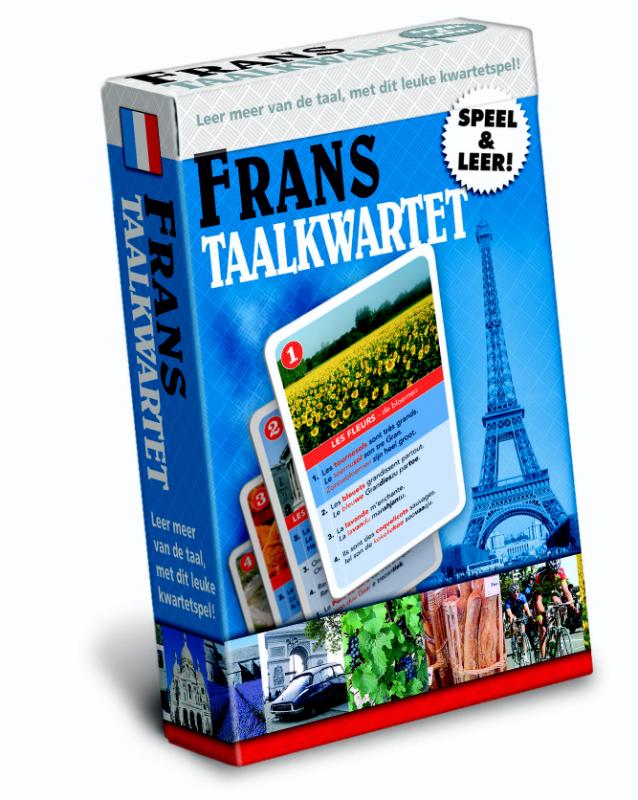
Spel Taalkwartet Frans | Scala Leuker Leren

Spelenderwijs woordjes en zinnetjes leren in een vreemde taal met mooie fotokwartetten. 18 kwartetten over allerlei onderwerpen zoals eten, drinken, vakantie, sport, gebouwen, vervoer.


Elk woord staat in de context van een hele zin, met uitspraakaanwijzingen. Om de kaart te winnen, moet je het woord in de vreemde taal uitspreken. Win je de betreffende kaart, dan staat daarop ook de Nederlandse vertaling. Je kunt het spel op 2 niveaus spelen: alleen op het woord of op de hele zin.

Per taal zijn er 18 kwartetten, dat zijn 72 zinnen. Plus 13 extra-uitlegkaartjes over de uitspraak, veelgebruikte uitdrukkingen, belangrijke werkwoorden, handige grammaticaregels.


Voor 2 – 4 spelers of teams.

Vanaf 9 jaar / groep 6.

€ 21.50
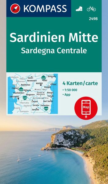
Wandelkaart - Fietskaart 2498 Sardinien Mitte - Sardegna Centrale | Kompass

Goede wandelkaart van centraal Sardinië met vrijwel alle topografische details als hoogtelijnen, vegetatie, schaduwtekening maar ook de ingetekende wandelroutes en in veel gevallen ook fietsroutes (MTB). Gevaarlijke routes worden als zodanig weergegeven met een bepaalde markering. Berghutten en campings zijn goed terug te vinden op deze kaarten.


Daarnaast staan de toeristische bezienswaardigheden met symbolen vermeld. Kleurgebruik kan soms vrij fel overkomen, daardoor oogt deze detailkaart wellicht wat druk, maar het blijft een goed leesbare kaart. Sommige kaarten zijn geplastificeerd, maar helaas niet allemaal. De graden staan aan de zijkanten van de kaart, daardoor te gebruiken voor GPS.


Steden/dorpen/gebieden:

Nuoro, Oristano, Siniscola, Orosei, Dorgali, Bolótana, Macomer, Cuglieri, Orroli, Guasila, Senorbi, Laconi, Tortoli, Bari Sardo, Ozieri, Budduso, Lode, Bitti


€ 19.95
Wandelgids Walking in Cornwall | Cicerone

40 half to full day rambles on the coasts and inland hills of Cornwall are explored in this guidebook.  Routes range from short, 2 mile strolls to long, wild walks of over 8 miles. With plenty of opportunities to combine routes together, this guide provides a wealth of variety for walkers of all abilities.


The guidebook is divided into 6 sections, including walks on Bodmin Moor (for which good navigational skills are required), the North Coast, Penwith and West Cornwall, the Inland Mining Districts, Land's End and the Lizard and Roseland Peninsulas. 


Cornwall has a lot to offer walkers; stunning coastal scenery and long stretches of wild moorland, with quiet estuaries cutting through high and rocky headlands. Birdlife and wildlife, from choughs to falcons to seals are found throughout the county, as are historical sites from the neolithic, to Iron Age hill forts and a long history of mining. The towns and villages of Cornwall, from the popular spots such as St Ives, Newquay and Padstow, to quiet inland hamlets and tucked away fishing villages are also included and provide perfect bases for going out to explore the country.


Alongside the 40 walking routes, this guidebook also includes plenty of practical information on getting to and around Cornwall, as well as details on each walk's distance, timing, terrain, ascent and nearest town. Throughout the walk descriptions, there are details of places of interest along the way, as well as annotated OS maps and stunning photography. The result is an ideal companion to stepping out and exploring the best of Cornwall.


Activities

Day walks, both coastal and inland


Seasons

There really isn't an off-season in Cornwall. The coastal walks are great at any time of year, as are the archaeological sites. Only Bodmin Moor is best left for the summer months.


Centres

Good bases are St Just, St Ives, Porthleven, St Agnes, St Austell, Padstow, Boscastle and Bude.


Difficulty

Most of the routes in this book are short easy walks following obvious paths and tracks, although a handful are more challenging. Walking boots and waterproofs are necessary, especially on exposed cliff-top walks, and for all the routes on Bodmin Moor.


Must See

Explore the amazing cliff-top paths of the Cornish coast. Discover signs of ancient man at scores of archaeological sites. Uncover the history of the Cornish tin mines. Stride out across the wildest parts of Bodmin Moor.

€ 9.95
Natuurgids Australia's Dangerous Animals | Waterford Press

Een bijzonder handige uitklapkaart met de meest voorkomende gevaarlijke dieren van Australië. Duidelijke illustraties, goede korte omschrijving van soort en leefgebied, geplastificeerd.

One of the most the most dangerous places for humans to live on earth, Australia is home to a variety of creatures that can severely injure humans on land and in the water. From the giant saltwater crocodile and great white shark to the tiny red-backed spider and dozens of poisonous snakes, travelers and residents alike now have a handy pocket reference that covers the creatures to watch out for, how to avoid encounters and basic first aid on how to treat different injuries. This beautifully illustrated guide highlights over 50 dangerous species


€ 13.95
Wegenkaart - landkaart Western Africa - Afrika westen | ITMB

Een degelijke kaart met aanduidingen van o.a. nationale parken, vliegveld, benzinepomp, dirt-roads en kleine plattegrond van hoofdstad. Als overzichtskaart goed te gebruiken.


This map, at 1:3,400,000 scale is ideal for travellers crossing Africa from Europe to central and southern parts of Africa by land. It covers from the southern tip of Spain through Morocco and western Algeria on one side to Mauritania and the Bight of Benin states of West Africa, as far east as western Nigeria. As a regional map, the detail provided is unsurpassed by any other map of this part of the world. It is the most detailed map to date of the West African states of Guinea, Guinea-Bissau, Liberia, and Sierra Leone. As is always the case with Africa, road information is presented in practical terms of road quality, not road designation. This is a practical map for travellers, so information has been provided with the greatest degree of accuracy possible, given that reliable information can be extremely difficult to determine. This is very much a map in progress, and we would welcome comments about it to assist future editions. The spelling of place names is as would be known in English, so Cote D'Ivoire is Ivory Coast.


Legend Includes:

Roads by classification, Rivers and Lakes, National Park, Airports, Points of Interests, Mining, Highways, Main Roads, Zoos, Fishing, , and much more...

€ 22.50
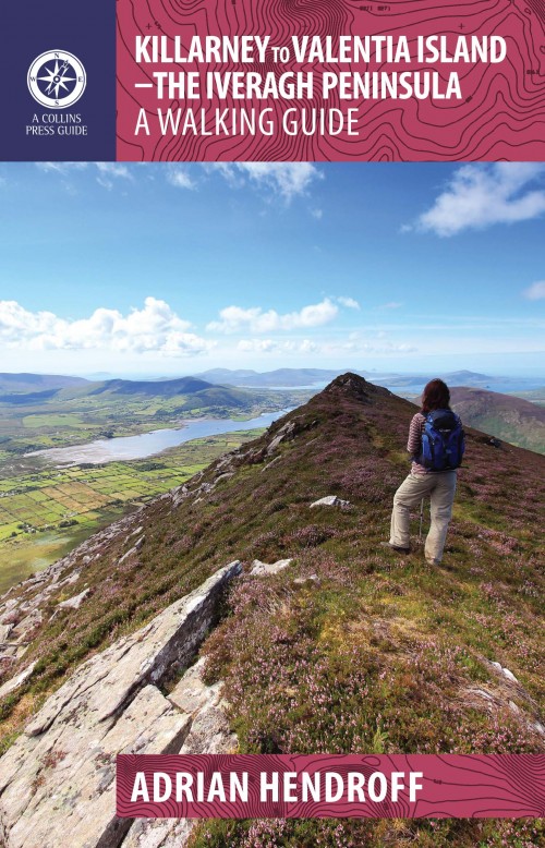
Wandelgids Killarney to Valentia Island - The Iveragh Peninsula | The Collins Press

Duidelijke wandelgids van dit specifieke deel van Ierland. Goede praktische informatie en zeker voor de GPS wandelaar handig met vermelde waypoints. Kaarten zijn schetsmatig, maar er wordt verwezen naar de benodigde topografische kaarten van Ierland. 

The Iveragh Peninsula, the largest in southwest Ireland, stretches from Killarney to Bolus Head and attracts thousands of visitors annually. The Ring of Kerry coastal road winds along its fringes and sandstone peaks soar high above. It is a landscape of raw and stunning beauty from the lakes that fill the corries to the spectacular cliff scenery along its coast. There is no better way to explore this landscape than on foot. This book helps you do just that with routes ranging from a few hours to full-day walks. Explore Valentia Island, the majestic MacGillycuddy’s Reeks and sections of The Kerry Way. Go off the beaten track and explore the coast, hills and woodlands from Killarney to Cahersiveen to Kenmare. Each route is prefaced with a reference summary and illustrated with maps and photographs. Route descriptions include GPS coordinates, navigation guidance, access notes and short variations. There is also material on the fauna, flora, folklore, history, geology and place names of each area.

€ 9.95
Natuurgids New Zealand wildlife | Waterford Press

Een bijzonder handige uitklapkaart met alle veelvoorkomende dieren van Nieuw Zeeland. Duidelijke illustraties, goede korte omschrijving van soort en leefgebied, geplastificeerd.

The unique, dinosaur-like, tuatara is one of thousands of species of animals inhabiting the diverse ecosystems found thoughout New Zealand, many endemic to the islands. This beautifully illustrated guide highlights over 140 familiar and unique species of mammals, birds, reptiles, amphibians, fishes and butterflies/insects and includes a map featuring prominent wildlife-viewing areas. Laminated for durability, this lightweight, pocket-sized folding guide is an excellent source of portable information and ideal for field use by visitors and residents alike.

€ 9.95
Natuurgids India Wildlife | Waterford Press

Handige uitklapkaart met een behoorlijk aantal dieren uit alle familie-groepen. Goede plaatjes zorgen voor de mogelijkheid van een snelle identificatie. 

India’s diverse habitats harbor an equally diverse assemblage of wildlife ranging from tigers and lions, to elephants, rhinos and flying lizards. This beautifully illustrated guide highlights over 140 familiar species of birds, mammals, reptiles, amphibians, seashore creatures, butterflies and the top wildlife viewing areas in the country. Researched by the leading conservation group – Wildlife SOS – India.

€ 9.95
Wandelkaart 403 Crete - Kreta | Road Editions

Uitstekende wandelkaart van een deel van Kreta. De kaart is gedrukt op watervast en onverscheurbaar papier. hierdoor gaat deze veel langer mee!


De wandelkaart heeft alle noodzakelijke details voor wandelen of fietsen: naast de topografische informatie als hoogtelijnen, alle plaatsnamen (zowel Grieks als Europees schrift), het wegennet, rivieren en stroompjes, nationale parken etc is er ook veel informatie over de toeristische aspecten als stranden, kloosters, campings en afstanen tussen dorpen of steden.


Voor de wandelaars is relevant dat de E4, het bekende lange-afstandswandelpad, staat ingetekend alsmede andere wandelroutes. Sporadisch staan ook fietsroutes ingetekend.

ROAD Cartography map, was created upon intensive fieldwork and using GIS (Geographical Information Systems) software, which results all geographic information with great accuracy. Contains every single road, trails, special routes for cycling and scenic routes, villages, attractions and plenty of other useful information. This ist the most handy and reliable map that is labeld under the quality name of ROAD cartopraphy.

€ 9.95
Wandelkaart 405 Crete - Kreta | Road Editions

Uitstekende wandelkaart van een deel van Kreta. De kaart is gedrukt op watervast en onverscheurbaar papier. hierdoor gaat deze veel langer mee!


De wandelkaart heeft alle noodzakelijke details voor wandelen of fietsen: naast de topografische informatie als hoogtelijnen, alle plaatsnamen (zowel Grieks als Europees schrift), het wegennet, rivieren en stroompjes, nationale parken etc is er ook veel informatie over de toeristische aspecten als stranden, kloosters, campings en afstanen tussen dorpen of steden.


Voor de wandelaars is relevant dat de E4, het bekende lange-afstandswandelpad, staat ingetekend alsmede andere wandelroutes. Sporadisch staan ook fietsroutes ingetekend.

ROAD Cartography map, was created upon intensive fieldwork and using GIS (Geographical Information Systems) software, which results all geographic information with great accuracy. Contains every single road, trails, special routes for cycling and scenic routes, villages, attractions and plenty of other useful information. This ist the most handy and reliable map that is labeld under the quality name of ROAD cartopraphy.

Abonneer op