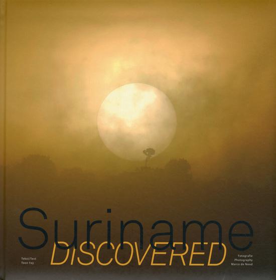
€ 35.95
Wandelgids Scotland | Cicerone

Als je wilt wandelen in Schotland is dit het ultieme naslagwerk.

A resource book covering the finest walks and climbs in Scotland, with its variety of wild landscapes ranging from the Southern Uplands to the great granite plateaus of the Cairngorms to the jagged arêtes of the Cuillin hills on the Isle of Skye. Whatever activity you are planning this guide has the information the independent mountain lover needs.

Scotland is a mountainous country with a wide variety of wild landscapes: there are the rolling hills of the Southern Uplands, the great granite plateaus of the Cairngorms, the steep castellated rock peaks of Torridon and the jagged narrow aretes and spires of the Cuillin hills on the Isle of Skye. Of the many majestic summits, 284 reach 3000ft or more; these are the Munros, the ascent of which is the aim of many walkers. Below them lie splendid pine forests, beautiful lochs, deep glens, rushing rivers; a magnificent northern landscape.

Whether you are planning a day scramble or a long-distance walk, Scotland World’s Mountain Range guide has the information the independent mountain lover needs.

• area-by-area descriptions of the Scottish mountains from south to north to help you identify the best locations for hill walking, mountaineering and ski touring

• classic ascents and walks described, from scrambles up Ben Nevis to ski tours in the Cairngorms

• information on accommodation, maps and guides

• a planning tool for long-distance treks in Scotland


€ 15.95
Wegenkaart - landkaart Uruguay - Paraguay | Reise Know-How Verlag

Tweetalige kaart (Engels en Duits). Door ingetekende lengte- en breedtegraden is het gebruik van GPS mogelijk. Met hoogtelijnen en uitgebreid wegennetwerk: daarnaast worden ook de afstanden tussen belangrijke plaatsen duidelijk leesbaar weergegeven. Het kleurgebruik is zodanig dat je een goede indruk krijgt van hoogteverschillen en soorten landschap. Natuurlijk staan de toeristische bezienswaardigheden duidelijk vermeld.


Gedrukt op water- en scheurvast papier! Polyart is een synthetisch product vrij van giftige stoffen dus duurzaam. Het papier gaat echt lang mee.


Topography is indicated by altitude colouring with numerous spot heights and names of mountain ranges and passes. Salt lakes, swamps, seasonal rivers and glacier are also shown. Detailed presentation of the road network includes minor roads and tracks and railways are also shown.


Internal administrative units are presented with their boundaries and names. National parks and other protected areas are highlighted. A wide range of symbols mark various places of interest. Map legends include English and all the maps have an index of localities.


€ 30.95
Wandelgids - Pelgrimsroute Der Pilgerweg nach Rom | Tyrolia

Goede duidelijke wandelgids met kaarten en beschrijving.

Auf der Brennerroute über Padua und Assisi. Mit detaillierten Karten für die gesamte Strecke.

Auf den Spuren von Kaisern und Pilgern in die Ewige Stadt

Endlich gibt es ihn, einen Führer, der Fußpilger über die alte Brennerroute bis zu den Gräbern der Apostelfürsten in die heilige Stadt Rom leitet. Der Autor verbindet dabei in insgesamt 55 Etappen den Abt-von-Stade-Weg von Innsbruck bis zur Grabeskirche des heiligen Antonius in Padua, pilgert am Antoniusweg von Padua bis zur Antonius-Einsiedelei bei Dovadola in der Emilia Romagna, folgt dann den Spuren des heiligen Franziskus auf dem Assisiweg von Dovadola bis Assisi, von wo uns dieser große Heilige nochmals auf dem Franziskusweg bis Rieti begleitet, um die Pilgerreise mit den letzten hundert Kilometern auf der Via di Roma bis zum Petersdom zu vollenden. 

Ein Buch mit praktischen Tipps und detaillierter Wegbeschreibung, mit Informationen über die spirituellen und kunsthistorischen Höhepunkte sowie mit detaillierten Karten für die gesamte Strecke. Ein Buch, das ca. 1200 km in einem Stück beschreibt und gleichzeitig dazu anregt, diese Pilgerreise auch in vier für sich geschlossenen Abschnitten von jeweils rund 14 Etappen zu begehen und zu erleben.

€ 9.95
Stadsplattegrond Fleximap London - Londen | Insight Guides

Geplastificeerde kaart van Londen, met register. Voor de 'gewone' toerist een handige kaart, geen groot formaat, overzichtelijk met alle belangrijke plaatsen goed weergegeven.


Flexi Map London is much more than just a laminated map. The Tourist Information section includes detailed descriptions and some stunning photographs of a carefully selected number of recommended sights, these sights are linked to the mapping by easy to find numbered markers. There is also an abundance of helpful information on getting around, tipping, opening times, public holidays, emergency telephone numbers and much more. 


The comprehensive index has been divided into different categories to make locating places as easy as possible. The laminated, tear-resistant finish is tough, weatherproof and can be written on using a non-permanent marker.


The main map shows Central London at a scale of 1:10.000 and highlights numerous places of interest such as public buildings, hotels and parks. 


For those wishing to travel slightly further afield there is also a map of Greater London, the scale of this map is 1:220 000 (1cm = 2.2km).


€ 24.50
Reisgids Lago Maggiore | Edicola

Weinig meren zo veelzijdig als het Lago Maggiore; majestueuze huizen en paleizen, pittoreske dorpjes, de fraaiste vergezichten, de meest authentieke restaurantjes, de mooiste wandelingen, de beste winkeltjes voor wijn, kaas en truffels en de meest uitdagende fietsroutes. Een verblijf aan de oevers van dit magische meer is zonder meer een verademing.


Auteur Liesbeth Paardekoper, zelf ruim tien jaar woonachtig aan het Lago, neemt de lezer mee naar de meest unieke en nog onontdekte plekjes van zowel het Lago Maggiore, als het nabij gelegen 'filmische' Lago d'Orta en natuurlijk ontbreken ook de beste tips voor Varese en Milaan niet. Lago Maggiore is een geheel herziene en geactualiseerde versie van het eerder verschenen Altijd Zondag.

€ 21.95
Wandelgids Sinai Trekking Guide | Trailblazer Guides

Bijzondere gids over fantastische tochten in de Sinai: wandelgids met goede schetskaarten, veel praktische informatie. Onmisbaar voor zo'n tocht!

Trek with the Bedouin and their camels and discover one of the most exciting new trekking destinations in the world. Egypt's Sinai peninsula is the small tooth of land between Africa and Asia, and the fabled Biblical setting of The Exodus.

It's a region of high mountains and sweeping deserts, home to crumbling Egyptian temples, Byzantine monasteries and more. The millions that visit Sinai each year come mostly for its beaches and reefs but for a true adventure, the best way to see Sinai is to trek with the Bedouin. Walking with their camels gives access to the most remote and waterless parts of the peninsula and no other mode of travel immerses you so fully in your surroundings nor gives such a close feel for the desert - its freedoms and hardships. Trekking is becoming ever-better established and it's perfectly possible to arrive and organise a trek yourself.Sinai can be trekked all year and it's on the doorstep of Europe. Budget airlines fly direct and the trekking is affordable if you organise everything independently. Once you finish on trail it's easy to stay occupied off it: there are coral reefs and sunken shipwrecks off shore and the tombs and temples of Egypt's Nile Valley are just a short hop over the Gulf.

❏ 74 detailed trekking maps - tricky junctions, places of interest. Comprehensive trail descriptions and GPS co-ordinates for classic treks and lesser-known routes. The best in the High Mountain Region (St. Katherine), Wadi Feiran and the Muzeina deserts.

❏ Practical information - planning your trip, getting to Sinai, arranging your trek and more: everything you need to know for every budget

❏ Town guides and maps - Sharm el Sheikh, Dahab, Nuweiba, St. Katherine, Wadi Feiran and others. Where to stay and eat, what to see and do

❏ History, culture, environment - full background sections on this land of legend

❏ Safety and green trekking - stay healthy and minimize your impact on a fragile desert

❏ GPS waypoints

❏ Plus - survival Arabic dictionary, snorkeling and diving, how to ride a camel etc.

Includes trekking options from one day to one week (or more) with 74 large-scale trekking maps showing walking times, water sources and all points of interest. Covers treks in the High Mountain, Wadi Feiran and desert regions.


● Mount Sinai (Jebel Musa)

● Jebel Katherina & Jebel Abbas Basha

● Jebel Umm Shomer

● Galt el Azraq  

● Jebel el Deir  

● Northern Peaks Circuit 

● Jebel Serbal Circuit

● Jebel Salla

● Wadi Feiran to Serabit el Khadem

● Ras Shaitan to Ein Hudera

● The Haduda Dune

● Desert Traverse


€ 289.00
Magneetbord Afrika, politiek, 91 x 118 cm | National Geographic

Mooie wandkaart van Afrika, staatkundig, met rustig kleurgebruik en helder kaartbeeld, Ondanks het wat kleiner formaat staan er toch heel wat topografische details op vermeld. 


The map presents Africa at 1: 9.328.000 and coverage includes the whole of the Mediterranean Basin, extending north to London. Islands in the Atlantic and the Indian Ocean are included on a separate inset. The base map has relief shading to show the continent’s topography, with additional graphics indicating deserts, swamps, salt flats, etc. The map shows the names of the main geographic features such as mountain ranges, deserts, peaks etc. Heights are given in metres, except for Kilimanjaro, shown in both metres and feet. In the Congo basin many of the tributaries are named. 


Country boundaries are shown in contrasting colours. All place names are in English, except for selected cities such as Cairo, Tripoli or Algiers where the original names are shown first (El Quahira, etc) with the English equivalents in brackets. Where appropriate, administrative, legislative and judicial capital cities are indicated (e.g. Dar Es Salam/Dodoma, Johannesburg/Cape Town/Bloemfontein, etc). 

€ 34.95
Wandkaart Azië, politiek, 84 x 96 cm | National Geographic

Mooie wandkaart van Azië, staatkundig, met rustig kleurgebruik en helder kaartbeeld, Ondanks het wat kleiner formaat staan er toch heel wat topografische details op vermeld. 


The map presents Asia at 1: 13,8120,000. Coverage includes the whole of the European part of Russia, extending up to the North Pole. In the south-east the island of New Guinea and the Bismarck Archipelago are shown as an inset. The base map has relief shading to show the continent’s topography, with additional graphics indicating deserts, swamps, glaciers, etc. The map shows the names of the numerous geographic features such as mountain ranges, deserts, peaks etc. Heights are given in feet. 


Country boundaries are in different colours and, where appropriate, disputed boundaries and territotial claims are marked. All place names are in English, except for some cities such as Bukhara, where the original name is shown first (Buxoro) with the English equivalent in brackets. 

€ 440.00
Magneetbord 84M Wereldkaart, politiek, 176 x 122 cm | National Geographic

Politieke wereldkaart van National Geographic. De klassieke blauwe vorm, met helder kaartbeeld. De landen hebben met kleuren duidelijke grenzen en er staan opvallend veel topografische details op. Ondanks de schaal een behoorlijk aantal plaatsnamen. Simpelweg een mooie kaart voor aan de muur op uw kantoor of studeerkamer op een groot formaat .


De kaart wordt in deze versie gelijmd op een plaat, voorzien van een mooie aluminium lijst en een ophangsysteem wordt meegeleverd. Daarnaast krijgt u een bakje bijgeleverd dat u er aan kunt bevestigen voor pennen, stiften of magneetjes.


We leveren bij dit magneetbord 1 set (10 stuks) gratis magneetjes. 

€ 13.95
Stadsplattegrond Wellington | Freytag & Berndt

Stadsplattegrond met register. Helder kaartbeeld waarbij de naamgeving goed leesbaar is weergegeven. Met de toeristische bezienswaardigheden in symbolen weergeven: monumenten, musea, stadions e.a. Daarnaast handige zaken als postkantoren, parkeergarages en stations. Veelal ook met een openbaar vervoer of metro kaart als inzet

Abonneer op