De naam zegt het al: een compacte versie van de veel geprezen Capitool serie. Eigenlijk vergelijkbaar met veel illustraties, veel aandacht voor cultuur en bevolking en hier en daar praktische informatie. Kleine versie, handig in de binnenzak.
- Met de uitneembare kaart vind je gemakkelijk de weg
- De schitterende foto’s brengen Dublin tot leven
- Compact formaat, ideaal om mee te nemen
- Diverse wandelroutes leiden je langs alle hoogtepunten van de streek
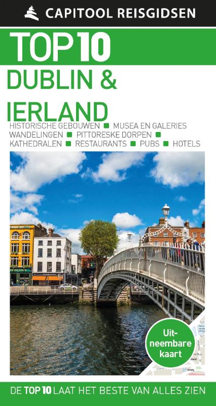
l Top 10 Dublin & Ierland
- Top 10 van onder andere de beste restaurants, de mooiste bezienswaardigheden en de leukste winkels
- Met de uitneembare kaart vind je gemakkelijk de weg
- De schitterende foto’s brengen de stad en het land tot leven
- Compact formaat, ideaal om mee te nemen
- Diverse routes leiden je door interessante wijken en prachtig natuurschoon
Top 10 Dublin & Ierland
De reisgids is opgebouwd uit top 10-lijsten die het beste van alles wat er in Dublin en Ierland te zien en te doen is, behandelen. In korte beschrijvingen lees je over de pubs, legendes en historische gebouwen.
Top 10 Dublin & Ierland bevat tips en praktische informatie voor tijdens het verblijf, zoals wat voor weer je kunt verwachten, waar je lekker kunt eten, gratis uitjes, welk hotel het beste is en gemakkelijk te volgen voorbeeldroutes zodat je in korte tijd zoveel mogelijk kunt zien. Of je nu een weekend of een hele week komt, dankzij de handige lijstjes heb je een snel overzicht van het beste wat de stad te bieden heeft. Zo zie je in een oogopslag wat de leukste plekken zijn voor kinderen en wanneer er sportfestiviteiten plaatsvinden.