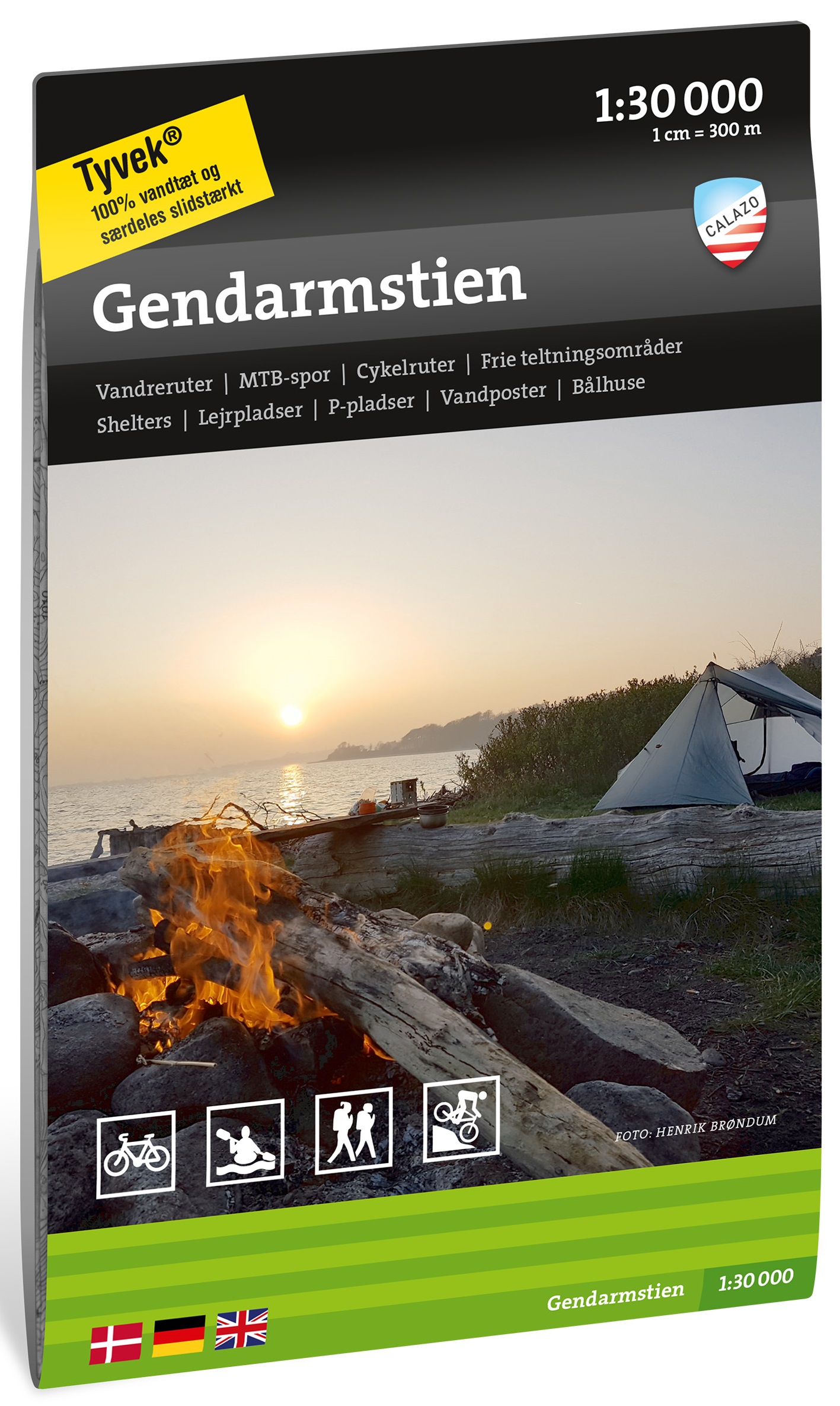
€ 26.50
Reisgids Rode gids Restaurantgids Deutschland - Duitsland 2024 | Michelin

Beroemde en beruchte rode Michelin jaargids voor Duitsland met tegenwoordig alleen nog adressen voor eten. Met het beroemde sterrensysteem als kwaliteitsgarantie. Veelal in steden of dorpen, minder op platteland. Met plattegronden.

Mehr als 2200 Restaurants mit Auszeichnung

Absolute Spitzenküche in 300 Sternerestaurants ( von *** bis * ), unser bestes Preis-Leistungs-Verhältnis in 460 Bib-Gourmand-Adressen und all die mit MICHELIN

Teller gekennzeichneten Restaurants, in denen man einfach gut isst.

Mehr als 1700 Hotels

Für einen besonderen Aufenthalt, vom Designhotel bis zum Landgasthof mit Charme, am Meer, in der Stadt....

€ 12.95
Reisgids Pocket Hong Kong | Lonely Planet

Pocket reisgidsen van Lonely Planet zijn een kleinere versie dan de 'echte' Planets. Vaak echter van bijzondere bestemmingen binnen een bepaald land waardoor er meer aandacht is en uitgebreidere tips zijn voor die bepaalde streek i.v.m. de grote Planets. Handzaam formaat, makkelijk in de binnenzak! Toch ook deze vol met praktische informatie.

Lonely Planet's Pocket Hong Kong is your guide to the city's best experiences and local life - neighbourhood by neighbourhood. Behold Victoria Peak vista, explore the famous night market and feast on dim sum; all with your trusted travel companion. Uncover the best of Hong Kong and make the most of your trip!

Inside Lonely Planet's Pocket Hong Kong:

Up-to-date information - all businesses were rechecked before publication to ensure they are still open after 2020's COVID-19 outbreak

Full-colour maps and travel photography throughout

Highlightsand itineraries help you tailor your trip to your personal needs and interests

Insider tips to save time and money and get around like a local, avoiding crowds and trouble spots

Essential infoat your fingertips - hours of operation, phone numbers, websites, transit tips, prices

Honest reviews for all budgets - eating, sightseeing, going out, shopping, hidden gems that most guidebooks miss

Convenient pull-out Hong Kong map (included in print version), plus over 18 colour neighbourhood maps

User-friendly layout with helpful icons, and organised by neighbourhood to help you pick the best spots to spend your time

Covers Hong Kong Island, Central, Sheung Wan, Lan Kwai Fong, Soho, Admiralty, Kowloon, the New Territories, Macau and more

The Perfect Choice: Lonely Planet's Pocket Hong Kong, an easy-to-use guide filled with top experiences - neighbourhood by neighbourhood - that literally fits in your pocket. Make the most of a quick trip to Hong Kong with trusted travel advice to get you straight to the heart of the city.

Looking for a comprehensive guide that recommends both popular and offbeat experiences, and extensively covers all of Hong Kong's neighbourhoods? Check out Lonely Planet's Hong Kong city guide.

Looking for more extensive coverage? Check out Lonely Planet's China guide for a comprehensive look at all that the country has to offer.


About Lonely Planet: Lonely Planet is a leading travel media company, providing both inspiring and trustworthy information for every kind of traveller since 1973. Over the past four decades, we've printed over 145 million guidebooks and phrasebooks for 120 languages, and grown a dedicated, passionate global community of travellers. You'll also find our content online, and in mobile apps, videos, 14 languages, armchair and lifestyle books, ebooks, and more, enabling you to explore every day.

'Lonely Planet guides are, quite simply, like no other.' - New York Times

'Lonely Planet. It's on everyone's bookshelves; it's in every traveller's hands. It's on mobile phones. It's on the Internet. It's everywhere, and it's telling entire generations of people how to travel the world.' - Fairfax Media (Australia)

€ 19.95
Fietsgids Parijs per fiets! | Radius Uitgeverij

In het Parijse straatbeeld zijn steeds meer fietsers te zien. En dat is terecht, want het is geweldig om de stad per fiets te verkennen.
Het is de ideale manier om lukraak door wijken te dwalen waar de toerist niet zo gauw komt. Gek genoeg zijn er nog steeds mensen die beweren dat fietsen onverantwoord is: zij hebben ongelijk! Er zijn de laatste jaren namelijk heel wat fietspaden langs de drukke boulevards aangelegd. Maar de onverwachte kanten van de stad komt u vooral tegen als u de stille wijken in gaat: de tochten uit deze gids brengen u erheen.
In deze gids beschrijft Joke Radius drie fietstochten door Parijs die langs water, parken, kerkhoven en boulevards gaan, over voormalige spoorwegtracés en door heel smalle straatjes. Naast veel café-terrassen zijn langs de route ook musea en aparte bezienswaardigheden aangegeven. Zo komt u in het nieuwe Parc de Bercy en het klassieke Parc de Monceau, fietst u langs het ‘Namaakmuseum’ en door het openluchtmuseum langs de Seine en ziet u de Parijse moskee en de Russische kathedraal.

De drie tochten van elk 25 à 30 kilometer lang kunnen zonder problemen ook in tweeën geknipt worden.
De kaarten geven duidelijk de route aan. 
Als extra zijn veel waardevolle tips voor Parijsgangers opgenomen zoals: wat te doen als het regent, waar kan ik kosteloos een concert bijwonen, waar logeer ik voor minder dan 25 Euro per nacht etc.

€ 269.50
Magneetbord - Wereldkaart 66M politiek, 136 x 86 cm | Maps International

Door het heldere en vrij felle kleurgebruik is deze kaart uitermate geschikt voor scholen, kantoren of gewoon als politieke wereldkaart thuis. De kleurstelling is zodanig dat elk land zich zeer goed onderscheidt van haar buren. De natuurkundige aspecten zijn minder goed te zien, al worden de gebergten door schaduwwerking goed uitgelicht. De nadruk ligt echter duidelijk op een ‘gewone’ wereldkaart. De belettering is uitstekend leesbaar door vetgedrukte naamgeving. Let op, Nederlandstalig, maten: 136 x 86 cm , zonder vlaggen., prijs is incl. BTW.

De kaart wordt in deze versie gelijmd op een plaat, voorzien van een mooie aluminium lijst en een ophangsysteem wordt meegeleverd. Daarnaast krijgt u een bakje bijgeleverd dat u er aan kunt bevestigen voor pennen, stiften of magneetjes.

Bij deze kaart wordt een set magneetjes (10 stuks) gratis meegeleverd

€ 25.95
Reisgids Rode gids Restaurantgids Espana 2024 - Spanje | Michelin

Beroemde en beruchte rode Michelin jaargids voor Spanje met tegenwoordig alleen nog adressen voor eten. Met het beroemde sterrensysteem als kwaliteitsgarantie. Veelal in steden of dorpen, minder op platteland. Met plattegronden. (let op: de -weinige- tekst is in het Spaans)


De reeks Michelin gidsen 2024. De referentie voor restaurants! Betrouwbaar en praktische gidsen, altijd en overal ter wereld. De beroemde gids met de 'sterren'! In deze gids worden bijna alle restaurants beoordeeld op prijs en kwaliteit.


€ 25.95
Reisgids France - Frankrijk | Lonely Planet

De perfecte reisgids voor zowel de georganiseerde als de zelfstandige reiziger. Naast een algemene inleiding van het land / streek vol met praktische informatie over hoe je er het beste kunt reizen: slapen, eten, vervoer, excursies ... alles kun je er in vinden. Engelstalig. Lonely Planet.

Lonely Planet's local travel experts reveal all you need to know to plan the trip of a lifetime to France.


Discover popular and off the beaten track experiences from people-watching in one of Bordeaux's atmospheric cafe-filled squares to cycling through one of the world's most famous vineyards in La Voie des Vignes, and paragliding over Lake Annecy.


Build a trip to remember with Lonely Planet's France Travel Guide:


Our classic guidebook format provides you with the most comprehensive level of information for planning multi-week trips

Updated with an all new structure and design so you can navigate France and connect experiences together with ease

Create your perfect trip with exciting itineraries for extended journeys combined with suggested day trips, walking tours, and activities to match your passions

Get fresh takes on must-visit sights from exploring the iconic Eiffel Tower to visiting troglodytes in the Loire, and riding the Aiguille du Midi cable car

Special features on wine tasting explained, hiking and skiing guide, Paris walking tours

Expert local recommendations on when to go, eating, drinking, nightlife, shopping, accommodation, adventure activities, festivals, and more

Essential information toolkit containing tips on arriving; transport; making the most of your time and money; LGBTIQ+ travel advice; useful words and phrases; accessibility; and responsible travel

Connect with French culture through stories that delve deep into local life, history, and traditions 

Inspiring full-colour travel photography and maps including a pull out map of Paris

Covers Paris, Lille, Flanders & the Somme, Normandy, Brittany, Champagne, Alsace, Lorraine, The Loire, Burgundy, Lyon, the Rhône Valley & the Auvergne, French Alps & Jura, Bordeaux to Biarritz, Dordogne & Lot, Languedoc-Roussillon, Toulouse & the Pyrenees, Provence, Côte d’Azur & Monaco, Corsica


Create a trip that's uniquely yours and get to the heart of this extraordinary country with Lonely Planet's France.


€ 20.95
Wandelgids 10 The South West Coast Path National Trail Guide | Aurum Press

Goede beschrijving van een deel van het beroemde South West Coast path in Cornwall. Men heeft gebruik gemaakt van zeer gedetailleerde kaarten van Ordnance Survey.

The South West Coast Path follows Britain's stunning coastline for 630 miles around the southern tip of Britain. This volume covers the 172 miles of the National Trail along the south Cornwall and Devon coast from Falmouth to the mouth of the Exe. It takes in some of Britain's most popular beaches and resorts, as well as arresting clifftop scenery, romantic coves and the spectacular 'drowned' estuaries of the Fal, the Yealm and the Dart. Whether you want golden sands, the steep streets of picturesque fishing villages, or a sight of the rare cirl bunting, this book is all you need as your guide to this wonderful walk. This new edition has been fully revised and updated for 2015 and completely resdesigned to feature many more colour photographs and much added information on the history, wildlife and cultural asociations of the landscape this stretch of the Trail traverses. National Trail Guides are the official guidebooks to the fifteen National Trails in England and Wales and are published in association with Walk Unlimited, the official body charged with developing and maintaining the Trails.

€ 20.95
Wandelgids 9 The South West Coast Path National Trail Guide | Aurum Press

Goede beschrijving van een deel van het beroemde South West Coast path in Cornwall. Men heeft gebruik gemaakt van zeer gedetailleerde kaarten van Ordnance Survey.

Part two of the official four-part series covering Britain's longest National Trail in detail. Contains easy to follow Ordnance Survey mapping for individual sections, detailed route descriptions for the National Trail and shorter, circular walks off it. Full colour throughout.

The South West Coast Path is the spectacular 630-mile (1008 km) National Trail around the tip of Britain. This volume features the section of the Path from Padstow to Falmouth, a distance of 169 miles (271 km). Following Natural England's acorn waymarks, the route hugs the coast right around Land's End and the Lizard, via the ports of St Ives and Penzance, This is the complete, official guide for the long-distance walker or the weekend stroller. National Trail Guides are the official guidebooks to the fifteen National Trails in England and Wales and are published in association with Natural England, the official body charged with developing and maintaining the Trails.

€ 20.95
Wandelgids 8 The South West Coast Path | Aurum Press

Goede beschrijving van een deel van het beroemde South West Coast path in Cornwall. Men heeft gebruik gemaakt van zeer gedetailleerde kaarten van Ordnance Survey.

Part one of the official four-part series covering Britain's longest National Trail in detail. Contains easy to follow Ordnance Survey mapping for individual sections, detailed route descriptions for the National Trail and shorter, circular walks off it. Full colour throughout.

The South West Coast Path is the spectacular 630-mile (1008-km) National Trail around the tip of Britain. This volume features the section of the Path from Minehead to Padstow, a distance of 163 miles (262 km). The Trail traces the beautiful coastline, through Exmoor National Park, Clovelly and Tintagel, following Natural England's acorn waymarks. This is the complete, official guide for the long distance walker or the weekend stroller. All you need is this one book. National Trail Guides are the official guidebooks to the fifteen National Trails in England and Wales and are published in association with Natural England, the official body charged with developing and maintaining the Trails.

€ 18.50
Wandelgids 008 Pathfinder Guides Kent | Ordnance Survey

Wandelgids van een deel van Engeland. Deze gids bevat 28 dagwandelingen, variërend van korte tochten tot pittige dagtochten. De bijbehorende kaarten zijn uitstekend: men heeft de topografische kaarten van Ordnance Survey gebruikt waarop de route is ingetekend. Daarnaast praktische informatie over de wandeling en wat beschrijvingen van het gebied.

Walkers in Kent enjoy a number of long-distance footpaths, including the North Downs Way, Wealdway, Pilgrims' Way and Greensand Way, and sections of them are incorporated into several walks in this guide. Routes starting at Tenterden and Penshurst wind through a typical Kentish landscape, characterised by orchards, medieval churches and oast houses.


Deal and Sandwich, featured on another walk, were once centres for smugglers, while walks along the cliffs of Dover and Folkestone evoke historic maritime events. In contrast, Romney Marsh and the Swale have a wild and lonely beauty which evoke a more contemplative mood.


28 circular, graded walks all tried and tested by seasoned walkers. The routes range from extended strolls to exhilarating hikes, so there is something for everyone.

Abonneer op