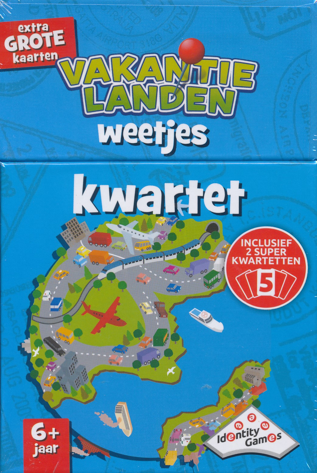
Kwartetten, het leuke kaartstpel voor kinderen! Zoek de 4 juiste kaarten bij elkaar van de diverse vakantielanden. Met prachtige foto's en leuke weetjes over vele Europese landen.
Spel voor 2-4 spelers vanaf 6 jaar.
Speelduur ca.20 minuten.

Kwartetten, het leuke kaartstpel voor kinderen! Zoek de 4 juiste kaarten bij elkaar van de diverse vakantielanden. Met prachtige foto's en leuke weetjes over vele Europese landen.
Spel voor 2-4 spelers vanaf 6 jaar.
Speelduur ca.20 minuten.

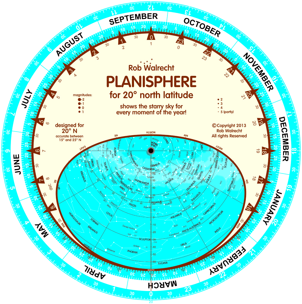
De planisfeer is hét hulpmiddel om de sterrenhemel, met al zijn sterrenbeelden en heldere sterren, te leren kennen. Een planisfeer bestaat uit een ronde kaart van de sterrenhemel, met de hemelpool in het middelpunt. Die sterrenkaart toont alle sterren, sterrenbeelden en objecten als nevels e.d. (zie verder), die in een bepaald gebied zichtbaar zijn. De sterrenhemel is echter niet steeds hetzelfde: sterren komen op en gaan onder en in de zomer zie je een ander deel van de sterrenhemel dan in de herfst, winter of lente.
Daarom bevat de planisfeer een tweede schijf, bovenop de sterrenkaart. Deze bevat een doorzichtige opening die laat zien welk gedeelte van de sterrenhemel op een bepaald moment echt zichtbaar is. En dat moment is heel eenvoudig in te stellen, met de datum en de tijd.
Voor gebruik in: Centraal Zuid-Amerika, Brazilië, Zuidelijk-Afrika, Madagaskar, Noord-Australië.
- ze tonen de sterrenhemel van elk moment van het jaar
- ze zijn zeer nauwkeurig, fraai, goed doordacht en goedkoop
- ze zijn gemakkelijk in te stellen op datum en tijd
- ze bevatten meer dan 700 sterren en circa 300 ‘verrekijker objecten’: sterrenstelsels, nevels, sterrenhopen, dubbelsterren enzovoort, die met het blote oog of een eenvoudige verrekijker zijn te bekijken!
- ze zijn geschikt voor 10 jaar en ouder
- ze gaan een leven lang mee... of langer!

Dubbele Engelse planisfeer voor 10° Noord en 10° Zuid! It is perfect anywhere between 15° North and 15° South. This particular planisphere is square (25 x 25 cm or 10 x 10 inches) and consists of four pages: two for the two star charts, one for the instructions and one with a concise introduction to astronomy.
For use in: Brazil, northern South America, Central Africa, South India, Sri Lanka, Indonesia and southern Indochina
De planisfeer is hét hulpmiddel om de sterrenhemel, met al zijn sterrenbeelden en heldere sterren, te leren kennen. Een planisfeer bestaat uit een ronde kaart van de sterrenhemel, met de hemelpool in het middelpunt. Die sterrenkaart toont alle sterren, sterrenbeelden en objecten als nevels e.d. (zie verder), die in een bepaald gebied zichtbaar zijn. De sterrenhemel is echter niet steeds hetzelfde: sterren komen op en gaan onder en in de zomer zie je een ander deel van de sterrenhemel dan in de herfst, winter of lente.
Daarom bevat de planisfeer een tweede schijf, bovenop de sterrenkaart. Deze bevat een doorzichtige opening die laat zien welk gedeelte van de sterrenhemel op een bepaald moment echt zichtbaar is. En dat moment is heel eenvoudig in te stellen, met de datum en de tijd.
- ze tonen de sterrenhemel van elk moment van het jaar
- ze zijn zeer nauwkeurig, fraai, goed doordacht en goedkoop
- ze zijn gemakkelijk in te stellen op datum en tijd
- ze bevatten meer dan 700 sterren en circa 300 ‘verrekijker objecten’: sterrenstelsels, nevels, sterrenhopen, dubbelsterren enzovoort, die met het blote oog of een eenvoudige verrekijker zijn te bekijken!
- ze zijn geschikt voor 10 jaar en ouder
- ze gaan een leven lang mee... of langer!
De planisfeer is hét hulpmiddel om de sterrenhemel, met al zijn sterrenbeelden en heldere sterren, te leren kennen. Een planisfeer bestaat uit een ronde kaart van de sterrenhemel, met de hemelpool in het middelpunt. Die sterrenkaart toont alle sterren, sterrenbeelden en objecten als nevels e.d. (zie verder), die in een bepaald gebied zichtbaar zijn. De sterrenhemel is echter niet steeds hetzelfde: sterren komen op en gaan onder en in de zomer zie je een ander deel van de sterrenhemel dan in de herfst, winter of lente.
Daarom bevat de planisfeer een tweede schijf, bovenop de sterrenkaart. Deze bevat een doorzichtige opening die laat zien welk gedeelte van de sterrenhemel op een bepaald moment echt zichtbaar is. En dat moment is heel eenvoudig in te stellen, met de datum en de tijd.
Voor gebruik in: Mexico, Caribische eilanden, Sahara, Saudi Arabie, Centraal India, Indochina en Taiwan.
- ze tonen de sterrenhemel van elk moment van het jaar
- ze zijn zeer nauwkeurig, fraai, goed doordacht en goedkoop
- ze zijn gemakkelijk in te stellen op datum en tijd
- ze bevatten meer dan 700 sterren en circa 300 ‘verrekijker objecten’: sterrenstelsels, nevels, sterrenhopen, dubbelsterren enzovoort, die met het blote oog of een eenvoudige verrekijker zijn te bekijken!
- ze zijn geschikt voor 10 jaar en ouder
- ze gaan een leven lang mee... of langer!
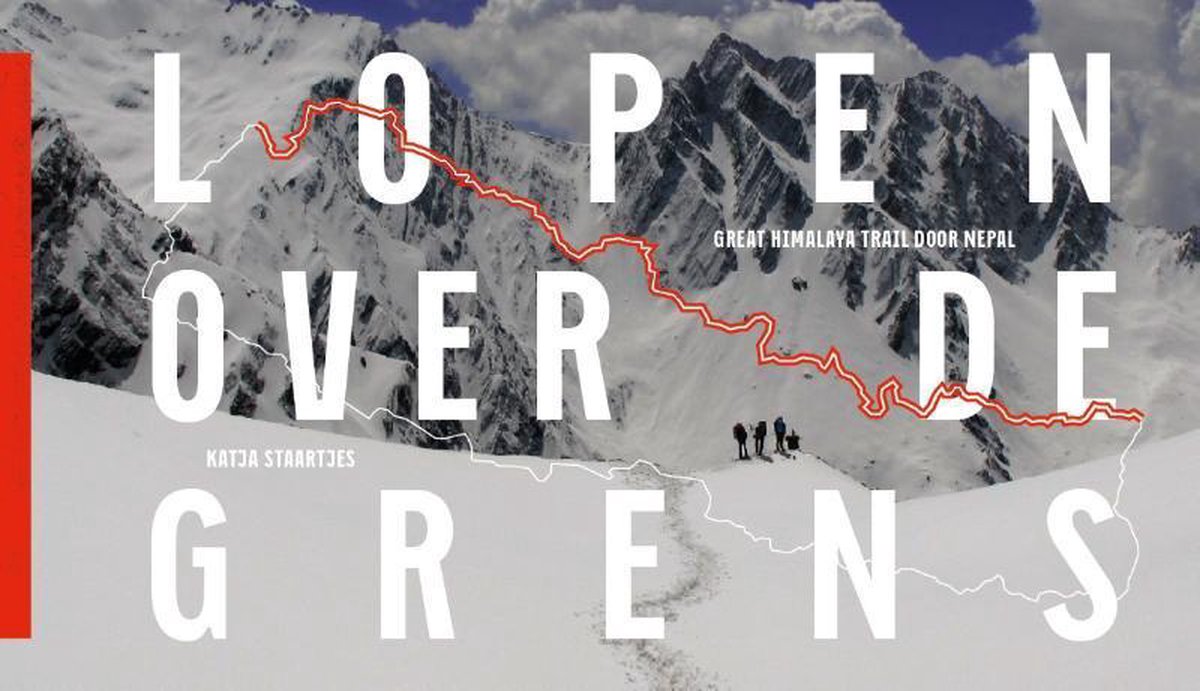
Grenzen. Ze geven aan tot hoe ver je kunt of mag gaan. Welke grenzen zijn er eigenlijk? Wie bepaalt welke grenzen voor wie gelden? Katja Staartjes en Henk Wesselius liepen 2000 kilometer langs de grens van Nepal: van het noordwestelijke naar het noordoostelijke drielandenpunt. Daarbij stegen en daalden ze 125.000 meter: ruim veertien maal de Mount Everest op en af vanaf zeeniveau. Tot hoogtes van 6200 meter en met zo min mogelijk georganiseerde hulp. De trektocht, een uitgebreide variant van de bekende Upper Great Himalaya Trail, doopten ze de Nepal Traverse.
In dit boek doet Staartjes verslag van de avonturen die zij en Wesselius in de wildernis meemaakten, de bijzondere ontmoetingen met de lokale bevolking en van de grenzen die ze tegenkwamen. Niet alleen de scheidslijnen tussen gebieden en groepen mensen, maar ook hun eigen grenzen. Dit alles in het decor van ruige natuur: het westen van Nepal is onontgonnen terrein voor reizigers, wat unieke foto's en verhalen oplevert.
Het nieuwe boek van Katja Staartjes (Lopen over de grens – Great Himalaya Trail door Nepal) verschijnt op 1 maart 2014. Het betreft een luxe, gebonden uitgave met een bijzonder formaat (26,5 x 15,1 cm). Het boek telt maar liefst 468 pagina’s, waarvan ruim 300 foto-pagina’s. Het boek is in nauwe samenwerking tot stand gekomen met Hemels van der Hart (ontwerp en opmaak Endeke Huisman) en Lecturis (kaartbewerking, lithografie en druk).
Het boek is het resultaat van de 2000 kilometer lange Nepal Traverse die Katja Staartjes en Henk Wesselius liepen van het noordwestelijke naar het noordoostelijke drielandenpunt. Een voettocht in vier etappes tussen de 900 en 6200 meter hoogte waarbij 125.000 meter gestegen en gedaald werd, gelijk aan veertien keer de Mount Everest op en af vanaf zeeniveau. Het boek bevat schitterende verhalen. Over ontzagwekkende natuur. Over indrukwekkende ontmoetingen en cultuur. En over grenzen. De grenzen tussen gebieden, de grenzen van de natuur en hun persoonlijke limiet.
Met de Nepal Traverse voltooiden Katja en Henk de extreme Upper Great Himalaya Trail. Dit is wereldwijd tot nu toe slechts een handvol mensen gelukt, meestal wordt namelijk de Lower-variant gedaan.
Een rijk geillustreerde reisgids met diepgaande teksten: één van de beste reisgidsen die er bestaan. Eerste deel bestaat uit een beschrijving van de unieke aspecten van de regio, daarna een deel echte reisgids en als afsluiting een deel met praktische informatie. De uitstekende informatie wordt vergezeld van prachtige foto's en heldere kaarten. Niet alleen om mee te nemen, maar ook om vooraf en zelfs achteraf weer in de stemming te komen.
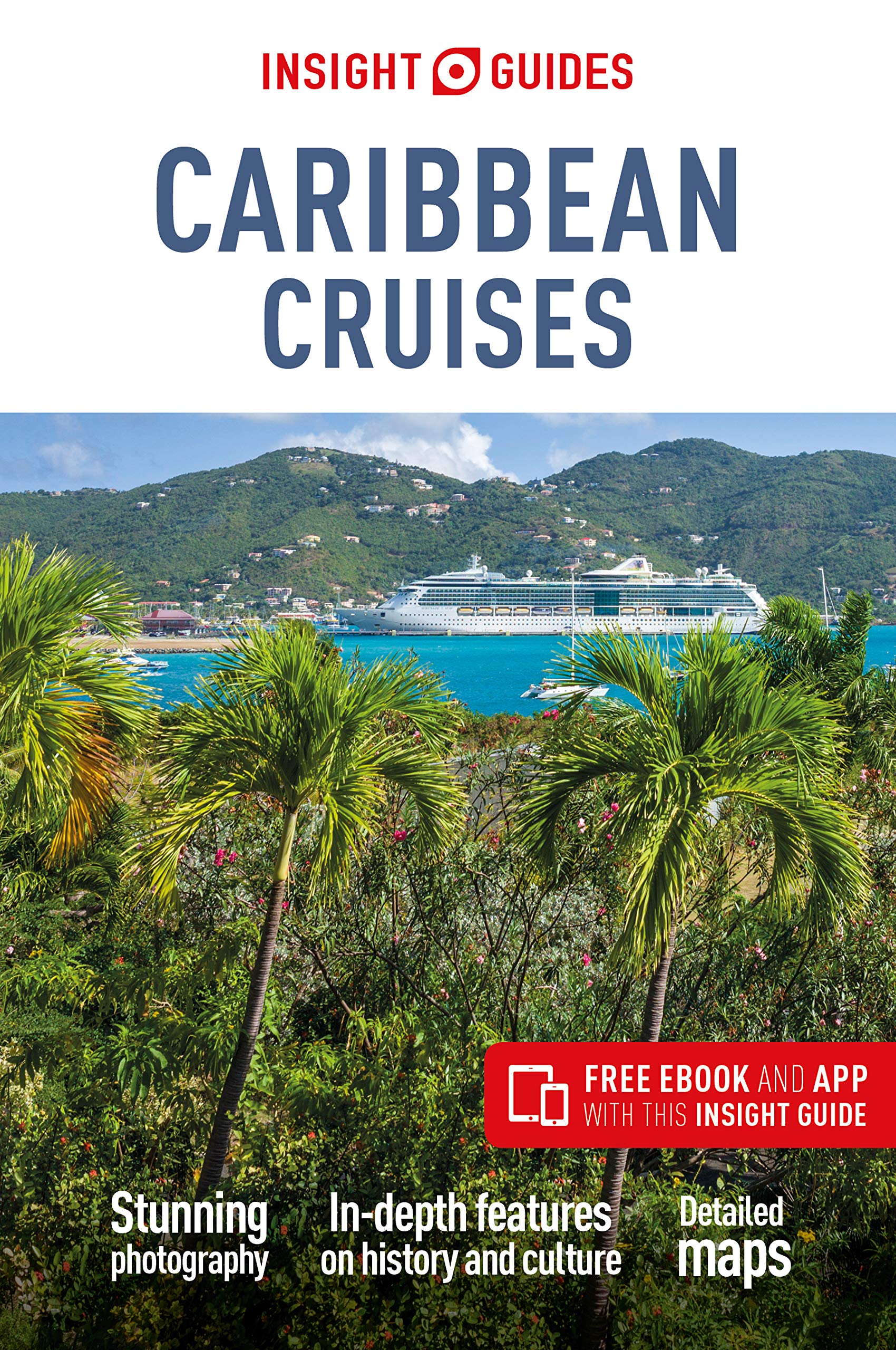
Insight Guide Caribbean Cruises is your comprehensive guide book to cruising the Caribbean, with full-color photos throughout combining with the lively narrative.
Our inspirational "Best of Caribbean Cruising" section outlines top attractions and activities not to be missed, while features by local writers cover not just the cruising angle but the cultural one too. Get to grips with the world of cruising: from choosing the right cruise for you and planning onboard activities vs shore excursions, to glimpses behind the scenes, cruiseship cuisine and pampering, and even tips on how to make your Caribbean cruising as environmentally friendly as possible. We cover the history and culture of this region in more detail than any other Caribbean cruises book on the market - our cultural information on the Caribbean people and the region's history, along with colorful features on subjects such as Carnival, Architecture and the Underwater World, give you the full picture of cruising in the Caribbean.
Twenty-nine Places chapters then visit Florida, Mexico and Central America before heading for the Caribbean, with the cruise lines' private islands also included.
A Main Attractions panel helps you get the most from each chapter, while plentiful full-color maps show you the way around, with dotted sights highlighting areas of interest. Finally, the Travel Tips cover all your practical needs, with a wealth of information to take you from Planning the Trip to Life on Board - including on-shore transportation and listings for where to eat, and even where to stay should you wish to extend your trip.
Covers: (Sailing The Western Shores) Florida Ports of Call; Mexico and Central America; (The Caribbean Arc) The Cayman Islands; Jamaica; (Sailing in the East) The Bahamas; Cuba: Havana; The Dominican Republic: Santo Domingo; Puerto Rico: San Juan; The US Virgin Islands; Sint Maarten/St-Martin; (Southern Sailing) The British Virgin Islands: Tortola; St-Barthelemy, Saba and Montserrat; Antigua; St Kitts and Nevis; Dominica; Martinique; Guadeloupe; St Lucia; Barbados; St Vincent and the Grenadines; Grenada and Carriacou; Trinidad and Tobago; Aruba and Curacao
Een rijk geillustreerde reisgids met diepgaande teksten: één van de beste reisgidsen die er bestaan. Eerste deel bestaat uit een beschrijving van de unieke aspecten van de regio, daarna een deel echte reisgids en als afsluiting een deel met praktische informatie. De uitstekende informatie wordt vergezeld van prachtige foto's en heldere kaarten. Niet alleen om mee te nemen, maar ook om vooraf en zelfs achteraf weer in de stemming te komen.
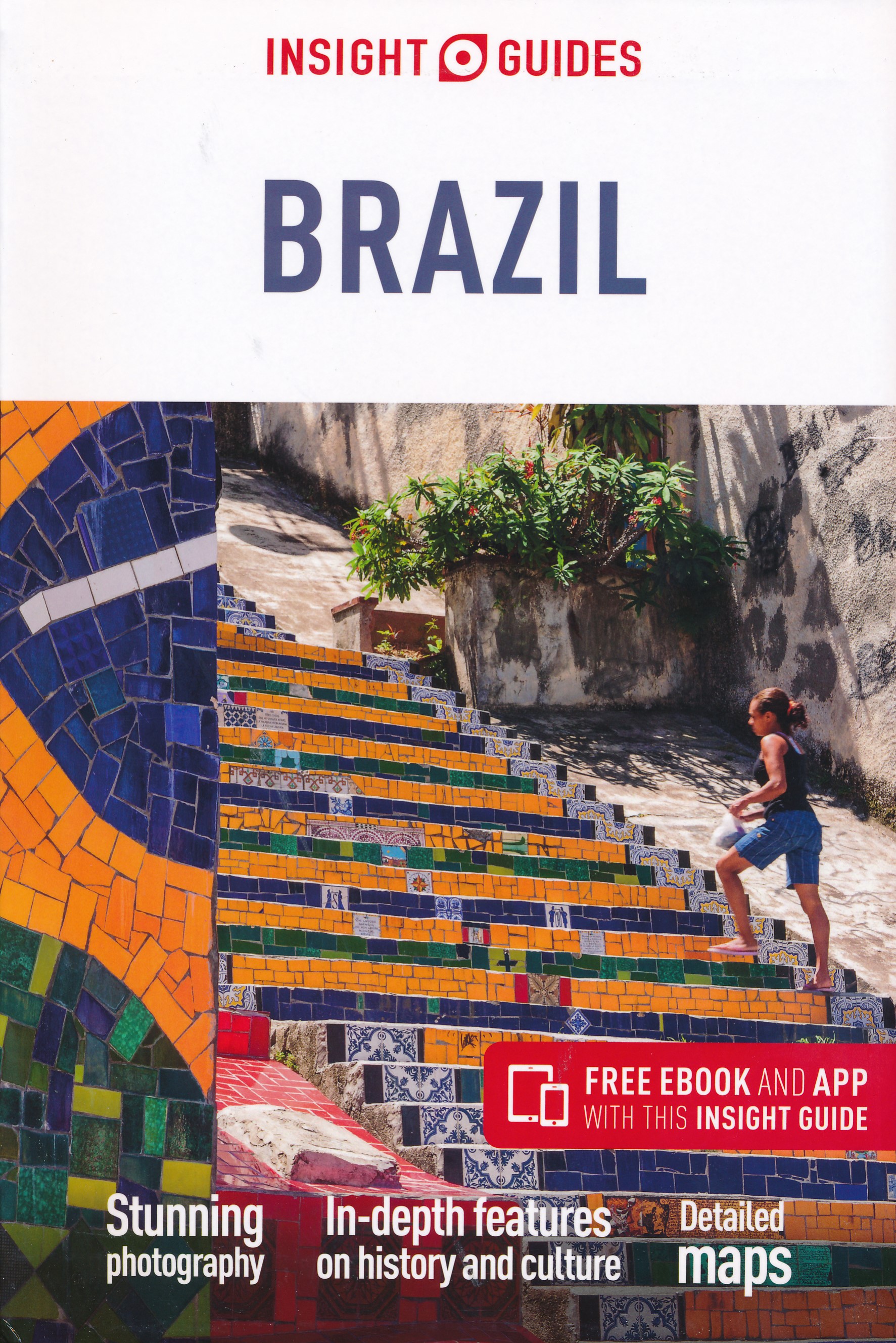
From deciding when to go to choosing what to see when you arrive, Insight Guide Brazil is all you need to plan your trip and experience the best of Brazil, with in-depth insider information on must-see, top attractions like the Sugar Loaf and Corcovado in Rio, the colonial architecture of Paraty and Pelourinho, the Pantanal and Iguaçu Falls and hidden cultural gems like Ouro Preto.
This book is ideal for travellers seeking immersive cultural experiences, from exploring colonial monuments, Amazonian lodges or Brazil's beautiful coastline, to discovering the thrill of its world-famous Carnaval.
- In-depth on history and culture: explore the region's vibrant history and culture, and understand its modern-day life, people and politics
- Excellent Editor's Choice: uncover the best of Brazil, which highlights the most special places to visit around the region
- Invaluable and practical maps: get around with ease thanks to detailed maps that pinpoint the key attractions featured in every chapter
- Informative tips: plan your travels easily with an A to Z of useful advice on everything from climate to tipping
- Inspirational colour photography: discover the best destinations, sights, and excursions, and be inspired by stunning imagery
- Innovative and unique extras: a free eBook and an app
- Inventivedesign makes for an engaging, easy-reading experience
- Covers: Rio de Janeiro, Rio de Janeiro State, São Paulo: City and State, Minas Gerais and Espirito Santo, Iguaçu Falls, Brasília and Goiás, The Pantanal, Bahia, Salvador, Sergipe and Alagoas, Recife and Pernambuco, Fernando de Noronha, The Far Northeast and the Amazon.

Turkey is a big country. Most visitors concentrate on Istanbul and the Izmir Coast, which is a shame as there are so many other interesting parts of the country to visit. This map covers the western third of the country as a double-sided map, covering from the Greek/Bulgarian border south to the Mediterranean and east to Eregli and Antalya in the east. Naturally, at a better scale, roads and road conditions can be shown to better advantage, and the ferry routes from Istanbul make more sense. The topography is now showing as contouring more easily, and we have been able to add the next layer of villages. The scale is still not appropriate for showing minor roads and tracks, but we have included as many as we feel we can. The map is printed on durable plastic paper, so will stand up to the rigours of travel quite well. A basin inset map of Istanbul has been included as well.
Legend Includes:
Road by classification, Motorways, Multilane Hwy, Main Roads, Rail Ways, Ferry Routes, National parks, Province Border, International Border, Lakes, Monuments, Caves, Ruins, Campsites, Hotels, Motels, Viewpoints, Point of Interests and much more...
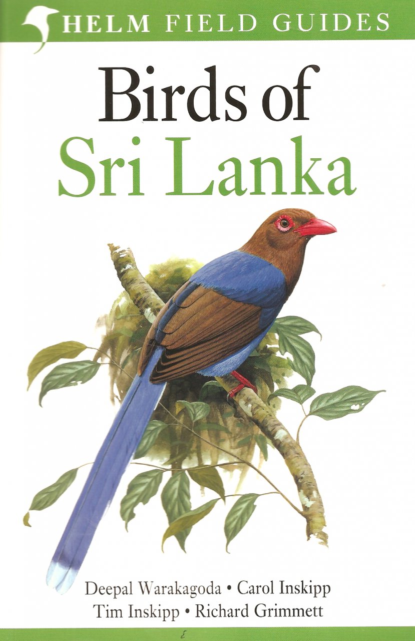
With a rich avifauna of more than 350 species that includes 29 endemics, the island of Sri Lanka is one of southern Asia's most popular birding destination. This new field guide provides full coverage of every species on the Sri Lanka list, including most vagrants, with particular emphasis placed on endemic species and races. Detailed text highlights key identification criteria, along with accurate colour maps. Packed with spectacular and detailed plates by leading bird artists such as Alan Harris, Tim Worfolk and John Cox, "Birds of Sri Lanka" is the definitive identification tool for the visiting birdwatcher and another majestic addition to the Helm Field Guides series.
"[...] The artwork is generally of a very high standard and, where appropriate, distinctive plumages and races are shown. The races illustrated are of course those that occur in Sri Lanka rather than elsewhere in the Indian Subcontinent. For species often seen and identifiable in flight, such as larger waterbirds, shorebirds, raptors, and seabirds, there are good flight illustrations.
Birds of Sri Lanka is an excellent piece of work and a true field guide, fitting neatly into a large pocket or small bag. In conclusion then, this is the crucial guide for anyone intent on birding on the beautiful island of Sri Lanka."
- Frank Lambert (10-04-2012), read the full review at The Birder's Library
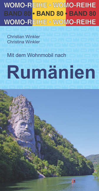
Bijzonder nuttige camperreisgids van een bepaald land of streek. Deze Duitstalige campergids beschrijft aan de hand van een aantal routes de mooiste gebieden. Naast een beschrijving van de routes zelf biedt de gids handige tips voor het reizen met de camper en een groot aantal officiële en niet-officiële standplaatsen. Deze camperplaatsen worden met GPS coordinaten duidelijk weergeven en zijn daardoor goed te vinden.
Handige reisgids voor de Camper. Aan de hand van 13 routes worden camperplaatsen in Roemenië beschreven met o.a. camper vriendelijke plekken en beschrijvingen van allerlei bezienswaardigheden.
Auf über 6500 km und in 13 Touren zu allen bekannten und vielen unbekannten Sehenswürdigkeiten Rumäniens.
Detailierte Beschreibung von rund 350 freien und geschützten Übernachtungs-, Picknick-, Bade-, Wander- und Stellplätzen sowie allen Campingplätzen entlang der Touren.
Präzise GPS-Daten zu allen Plätzen und Informationen zur Straßenbeschaffenheit.
Durch malerische Dörfer zu den beeindruckendsten Kulturstätten, wie den Kirchenburgen Siebenbürgens, den Moldauklöstern der Bukowina und den Holzkirchen der Maramuresch.
Auf fantastischen Pässen über die wilden Karpaten und zu den besten Plätzen für Bärensichtungen.
Heiße Quellen, kalte Höhlen und die schönsten Strände der Schwarzmeerküste.
Rundgänge und extra Wissen zu über 20 Städten wie Bukarest, Klausenburg, Temesvar, Hermannstadt, Kronstadt und Konstanza.
Tipps zu allen Nationalparks und Wandergebieten entlang der Route, inklusive dem Biosphärenreservat Donaudelta.
Viele Sehenswürdigkeiten wie Museen, Schlösser, Burgen, Höhlen, Klöster etc. mit detailierten Beschreibungen, Öffnungszeiten und Eintrittspreisen.
Umfangreiche Tipps und Hintergrundinformationen zu Land, Leuten und Kultur.
Über 250 Farbfotos, 15 informative Anreise-, Touren- und Übersichtskarten.